27/01/2026 – Weather in Cornwall – Yellow Weather Warning For Wind
Storm Chandra Brings Flooding Risk and Damaging Winds Across the Region
The Met Office has issued two weather warnings as Storm Chandra moves through, bringing heavy rain overnight and very strong winds through Tuesday 27th January 2026.
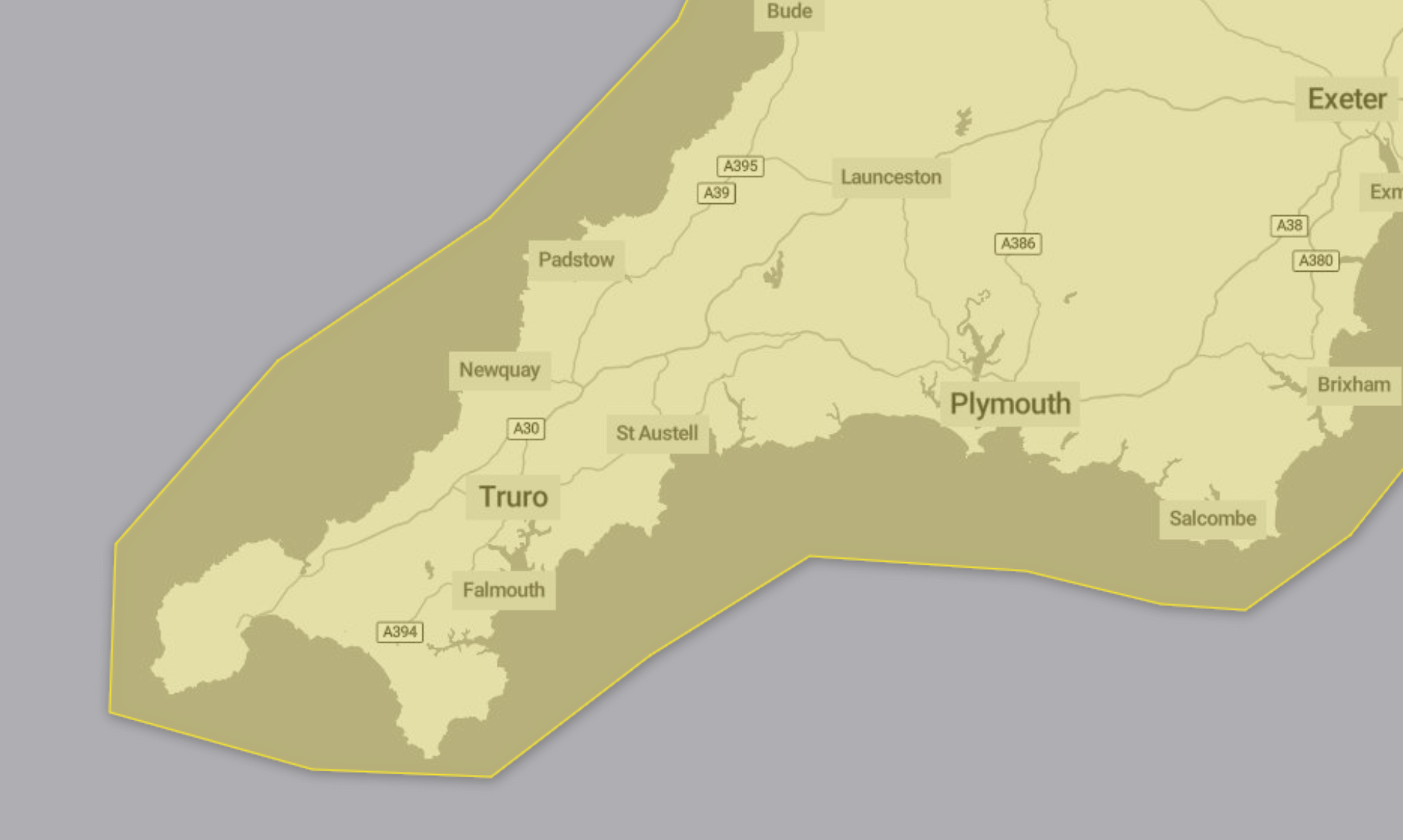
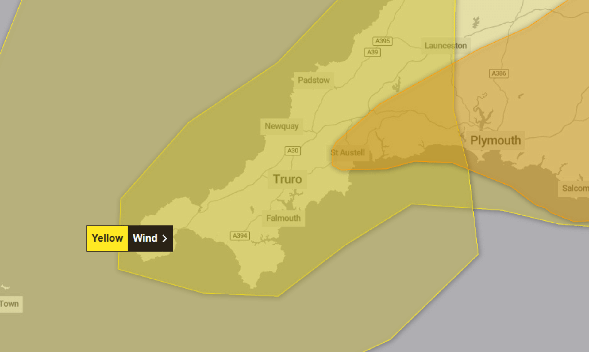
An amber weather warning for rain was in place for parts of Cornwall from 5.00pm on Monday 26th January until 9.00am today, while a yellow weather warning for wind runs from 5.00am until 4.00pm today.
Amber Warning for Rain
Storm Chandra brought persistent and at times heavy rain later on Monday and overnight into Tuesday morning.
Rainfall totals of 30 to 50mm are expected widely, with 60 to 80mm possible across some higher ground, particularly over south Dartmoor. With the ground already saturated, this increases the likelihood of flooding and disruption, especially during Tuesday morning.
The Met Office says impacts may include:
-
Homes and businesses likely to be flooded, causing damage to some buildings
-
Fast flowing or deep floodwater posing a danger to life
-
Delays and some cancellations to bus and train services
-
Difficult driving conditions due to spray and flooding, with some road closures
-
A good chance that some communities could be cut off by flooded roads
-
Power cuts and loss of other services to homes and businesses
-
Landslides possible in prone locations
The amber warning reflects a medium likelihood and medium impact.
Yellow Warning for Wind
Very strong south to southwesterly winds are expected to develop through Tuesday morning, associated with Storm Chandra.
Peak gusts of 50 to 60mph inland are forecast, rising to 60 to 70mph along exposed coasts. There is also a small chance of gusts reaching up to 80mph for parts of the Isles of Scilly and Pembrokeshire. Winds are expected to ease later in the afternoon.
Possible impacts include:
-
Disruption to road, rail, air and ferry services, with longer journey times and cancellations
-
Some roads and bridges potentially closing
-
Power cuts affecting homes and services such as mobile phone coverage
-
Damage to buildings, including tiles blown from roofs
-
Risk of injury or danger to life from flying debris
-
Danger to life along the coast from large waves and beach material being thrown onto sea fronts, coastal roads and properties
The yellow warning has a low likelihood but medium impact, according to the Met Office.
Safety Advice
People are advised to secure loose items around their homes such as bins, garden furniture, trampolines, sheds and fences.
Anyone travelling is encouraged to check road conditions and public transport timetables and adjust plans where necessary. Preparing for potential power cuts by having torches, spare batteries and mobile phone power packs to hand is also recommended.
Along the coast, the Met Office warns that large breaking waves can be dangerous even from the shore. People are advised to keep well back from the sea, take care near cliffs, and keep dogs on a lead. In an emergency, call 999 and ask for the Coastguard.
Floodwater should be avoided, whether driving, walking or swimming. Anyone affected by fast flowing or deep water is advised to call 999 and wait for help.
Weather warnings may change quickly, and people are encouraged to stay up to date with the latest local forecast and follow advice from emergency services and local authorities.
Share This Story, Choose Your Platform!
To keep up with the latest cornish news follow us below
Follow CornishStuff on Facebook - Like our Facebook page to get the latest news in your feed and join in the discussions in the comments. Click here to give us a like!
Follow us on Twitter - For the latest breaking news in Cornwall and the latest stories, click here to follow CornishStuff on X.
Follow us on Instagram - We also put the latest news in our Instagram Stories. Click here to follow CornishStuff on Instagram.
You Might Also Be Interested In


Don’t Miss What’s Happening in Cornwall
Join others in Cornwall by receiving the latest daily news in Cornwall, sent direct to your inbox.