01/12/2025 – Weather in Cornwall – Yellow Weather Warning For Rain
The Met Office has issued a yellow weather warning for rain from 00:00 today, Monday 1st December, until 03:00 tomorrow, with heavy rain expected to bring some disruption.
What the Met Office Says Could Happen
According to the warning, there is a slight chance of delays or cancellations to train and bus services where flooding occurs. Spray and flooding could make driving difficult and may lead to some road closures.
There is also a slight chance of power cuts and the loss of other services to homes and businesses. The Met Office adds that there is a small chance some communities could become cut off by flooded roads, and a small chance that homes and businesses could be flooded, causing damage to buildings.
How Much Rain Is Expected?
An area of heavy rain will move in from the west late Sunday evening and become widespread early today. It is expected to clear eastwards on Monday night.
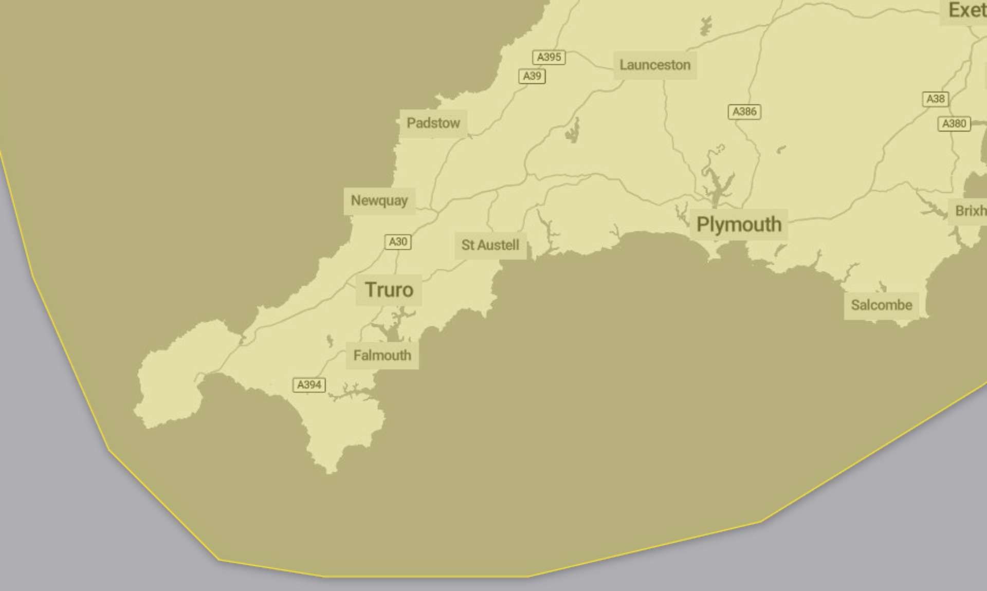
Rainfall totals across the region are expected to reach 20 to 30 mm quite widely. Higher totals of 50 to 80 mm are possible across high ground in southwest England and Wales, with very localised totals of 80 to 120 mm in parts of south Wales and Eryri.
Strong south to southwesterly winds will accompany the rain, with gales possible around coasts and over high ground.
Advice from the Met Office
The Met Office advises people to check if their property could be at risk of flooding and to consider preparing a flood plan and emergency flood kit.
Those travelling are urged to check road conditions and public transport timetables and amend travel plans if needed.
People are encouraged to prepare for potential power cuts by gathering torches, batteries, a mobile phone power pack and other essential items.
The Met Office also reminds everyone to stay up to date with the latest forecasts, as weather warnings can change quickly.
Why a Yellow Warning?
The warning is classified as yellow due to a very low likelihood paired with a medium impact.
South West England weather forecast
Headline:
An unsettled week to come.
Today:
A murky and wet start for most, as a weather system pushes northeastwards bringing widespread and prolonged outbreaks of rain, with heavy downpours and strong gusty winds likely. Conditions worst felt in the west, with coastal gales possible. Feeling mild. Maximum temperature 13 °C.
Tonight:
Wet and windy weather persisting through the evening, but overnight winds will gradually ease, with cloud and rain clearing to the northeast, though scattered showers feed in behind. Minimum temperature 7 °C.
Tuesday:
A brighter start, though patchy cloud and scattered showers continue for many. Showers becoming more frequent through the afternoon, with heavy downpours and a chance of thunder. Breezy at times. Maximum temperature 11 °C.
Outlook for Wednesday to Friday:
Wednesday brings another day of sunny spells with occasional showers. Turning cloudy from the west overnight as the next weather system brings further rain into Thursday and Friday. Often breezy.
Updated:
Share This Story, Choose Your Platform!
To keep up with the latest cornish news follow us below
Follow CornishStuff on Facebook - Like our Facebook page to get the latest news in your feed and join in the discussions in the comments. Click here to give us a like!
Follow us on Twitter - For the latest breaking news in Cornwall and the latest stories, click here to follow CornishStuff on X.
Follow us on Instagram - We also put the latest news in our Instagram Stories. Click here to follow CornishStuff on Instagram.
You Might Also Be Interested In


Don’t Miss What’s Happening in Cornwall
Join others in Cornwall by receiving the latest daily news in Cornwall, sent direct to your inbox.