09/02/2026 – Weather in Cornwall – Yellow Weather Warning For Rain
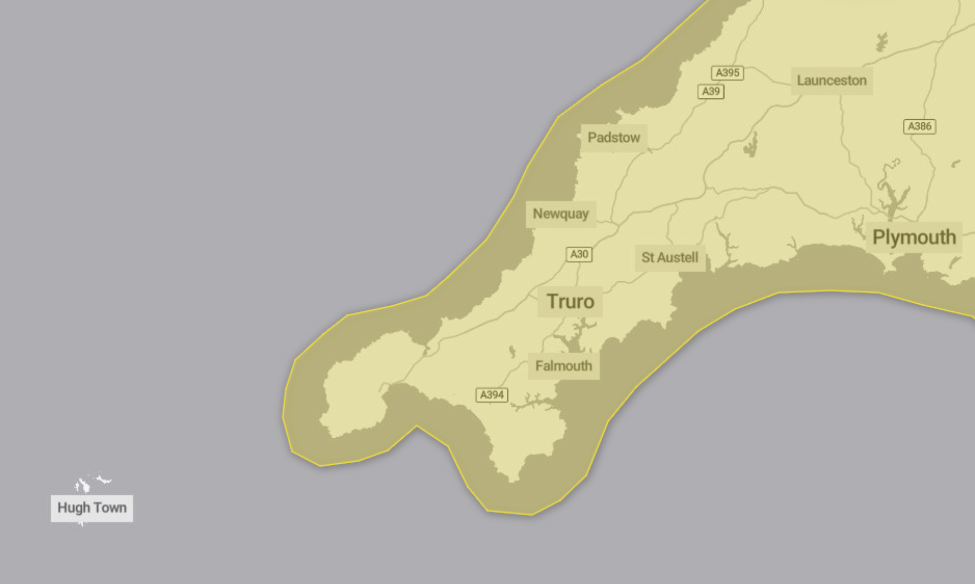
A yellow weather warning for rain has been issued by the Met Office, covering Monday 9th February from 12:00 until 23:59.
Heavy rain during the afternoon and evening may lead to flooding and disruption, particularly on roads and public transport.
What to Expect
The warning says spray and flooding on roads are likely, which could make journey times longer. Bus and train services are also likely to be affected, with delays possible.
There is a chance that a small number of homes and businesses could experience flooding. The Met Office also says there is a possibility of some interruption to power supplies and other services.
Rainfall Details
Bands of rain and heavy showers are expected to move east across southern parts of England and Wales during the afternoon and evening. Rainfall totals of 10 to 15mm are likely in many areas, with 20 to 30mm possible in places exposed to strong south to southeasterly winds.
Advice for the Public
People are advised to check whether their property could be at risk of flooding and, if so, consider preparing a flood plan and an emergency flood kit.
Those travelling are encouraged to check road conditions if driving, or bus and train timetables, and to amend travel plans if necessary.
The Met Office also advises preparing for potential power cuts by gathering items such as torches, batteries, a mobile phone power pack and other essential supplies. It adds that weather warnings can change quickly and recommends staying up to date with the local forecast.
Why the Warning Is Yellow
The warning is classified as yellow because it has a medium likelihood and a low impact.
Flooding Risk Grows as Heavy Rain Hits South West This Week
Flood warnings are in force for parts of England, with further heavy rain forecast across the South West this week.
An update issued by the Environment Agency at 06:58 (UTC) on Monday 9th February 2026 warns that flooding is possible in places as unsettled weather continues.
What’s expected today
Monday is forecast to be cloudy with periods of rain. The rain is expected to be most persistent and heaviest in western areas before pushing eastwards. Showers will follow in the far west, accompanied by brisk south to southeasterly winds.
Temperatures are expected to remain mild, with a maximum of 11°C.
Tonight’s outlook
Heavy rain is forecast to continue clearing eastwards this evening, with flooding possible. Conditions are expected to turn drier overnight, although a few showers may still occur. Winds are forecast to ease, with minimum temperatures around 5°C.
More rain on Tuesday
Tuesday is expected to start murky in eastern areas, with some drizzle in places. Another heavy band of rain is then forecast to move in from the west and push eastwards through the day. It will be breezy, particularly along the coast, with temperatures reaching up to 13°C.
Looking ahead to midweek
The outlook from Wednesday to Friday remains unsettled. Further rain or showers are expected, with some spells likely to be heavy and prolonged. This brings an ongoing risk of further flooding in some areas.
By the end of the week, conditions are forecast to turn colder but brighter.
Share This Story, Choose Your Platform!
To keep up with the latest cornish news follow us below
Follow CornishStuff on Facebook - Like our Facebook page to get the latest news in your feed and join in the discussions in the comments. Click here to give us a like!
Follow us on Twitter - For the latest breaking news in Cornwall and the latest stories, click here to follow CornishStuff on X.
Follow us on Instagram - We also put the latest news in our Instagram Stories. Click here to follow CornishStuff on Instagram.
You Might Also Be Interested In


Don’t Miss What’s Happening in Cornwall
Join others in Cornwall by receiving the latest daily news in Cornwall, sent direct to your inbox.