12/05/2025 – Weather in Cornwall – Yellow Weather Warning For Thunderstorms
Thunderstorms Could Cause Flash Flooding and Power Cuts in Cornwall Today
Met Office issues yellow warning for Monday afternoon and evening
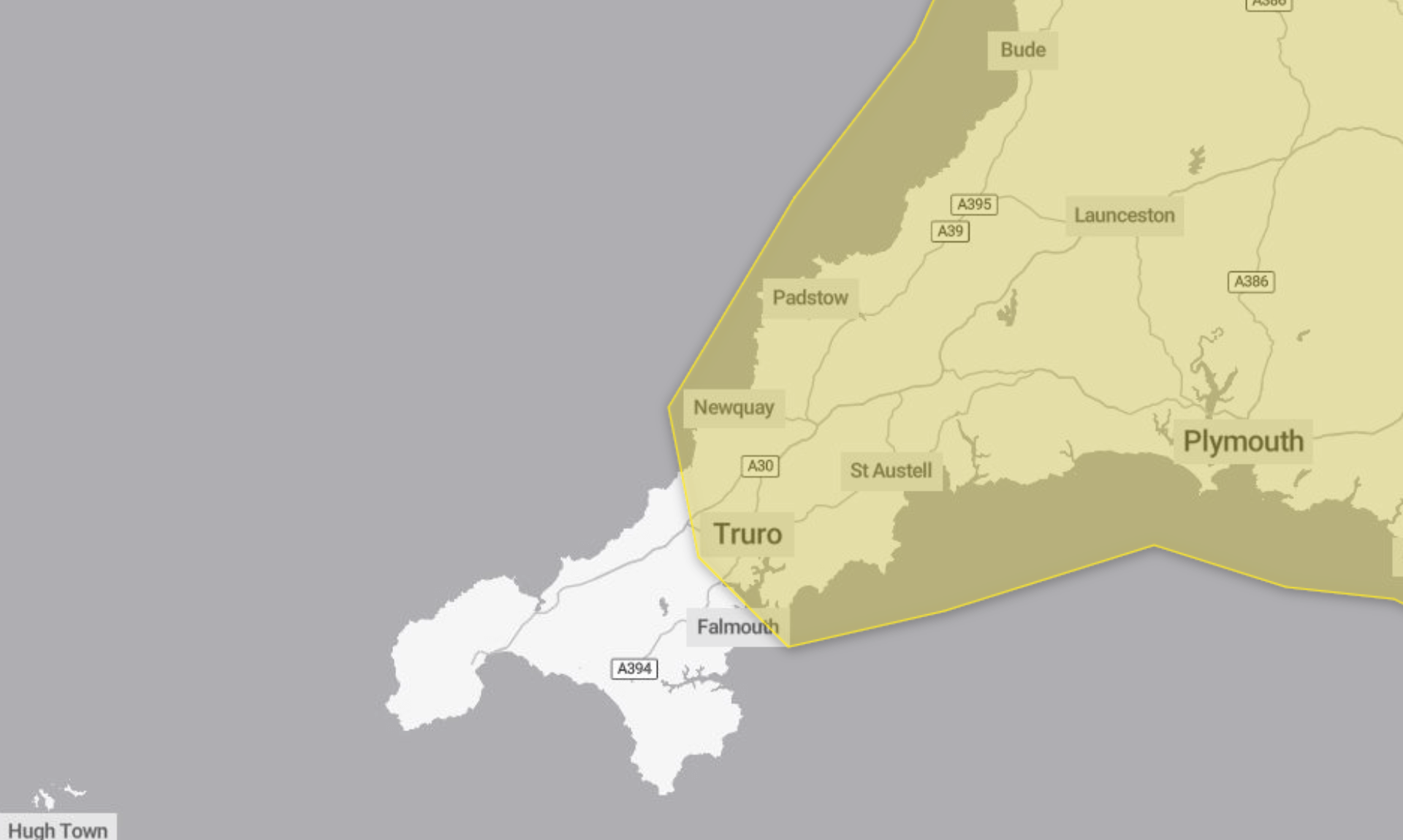
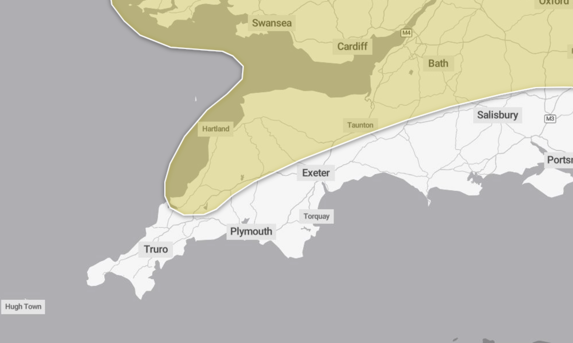
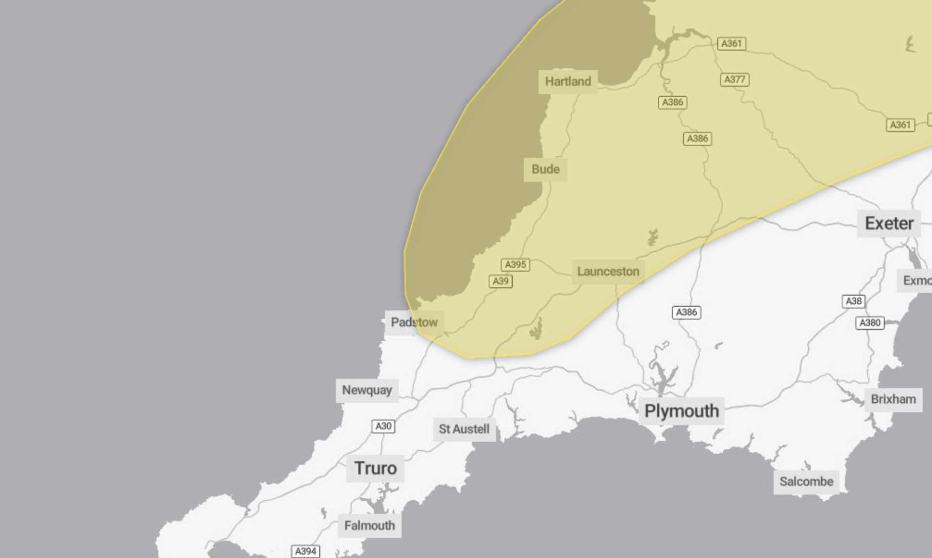
The Met Office has issued a yellow weather warning for thunderstorms today, Monday 12th May, with the potential for flash flooding, travel disruption, and power cuts across parts of Cornwall.
The warning is in place from 12pm to 10pm and covers the risk of scattered, fast-moving thunderstorms developing throughout the afternoon.
Heavy downpours and lightning expected
According to the Met Office, some areas could see 20-30mm of rain in under an hour, with isolated spots receiving 40-50mm within one to two hours. Although these showers will move quickly, they may still be intense and cause localised flooding.
“Spray and sudden flooding could lead to difficult driving conditions and some road closures,” the warning states.
Additional hazards include lightning strikes, hail, and strong gusty winds.
Possible impact on travel and services
The yellow warning also notes that there is a chance of:
-
Train and bus delays or cancellations
-
Power cuts
-
Damage to homes and buildings from flooding, lightning, hail or wind
“There is a small chance that homes and businesses could be flooded quickly,” the Met Office warns.
Advice from the Met Office
The Met Office recommends preparing for flash flooding if you live in an at-risk area. This includes having a flood plan and an emergency flood kit ready.
Other precautions include:
-
Securing moveable outdoor items like bins, trampolines, gazebos, and garden furniture
-
Checking travel routes before heading out
-
Gathering torches, batteries and a mobile phone power pack in case of power cuts
-
Seeking shelter in a car or enclosed building if you hear thunder, and avoiding trees and elevated areas
The warning comes with a “very low likelihood” but a “medium impact”, meaning disruption may be limited in scope but significant where it does occur.
Stay informed
The Met Office urges people to stay up to date with local weather forecasts and be prepared for conditions to change quickly throughout the day.
South West England weather forecast
Headline:
Warm sunny spells and scattered showers or thunderstorms developing Monday.
Today:
Largely dry with sunny spells throughout the day. However, the clouds will bubble up with some scattered heavy showers and thunderstorms breaking out during the afternoon. Risk of hail. Feeling rather warm in the sunshine between the showers. Light winds. Maximum temperature 23 °C.
Tonight:
Any showers or thunderstorms gradually easing to leave a largely dry night, with some clear spells. Some isolated mist and fog patches forming in places by dawn. Generally mild. Minimum temperature 5 °C.
Tuesday:
Early isolated mist and fog patches soon clearing to give a mostly fine day, with warm sunny spells. Chance of further showers breaking out towards the east during the afternoon. Maximum temperature 24 °C.
Outlook for Wednesday to Friday:
Staying fine and settled through the remainder of the week. Dry with plenty of sunshine by day, with clear skies overnight. Temperatures staying above average, but with some cooler nights.
Updated:
Share This Story, Choose Your Platform!
To keep up with the latest cornish news follow us below
Follow CornishStuff on Facebook - Like our Facebook page to get the latest news in your feed and join in the discussions in the comments. Click here to give us a like!
Follow us on Twitter - For the latest breaking news in Cornwall and the latest stories, click here to follow CornishStuff on X.
Follow us on Instagram - We also put the latest news in our Instagram Stories. Click here to follow CornishStuff on Instagram.
You Might Also Be Interested In


Don’t Miss What’s Happening in Cornwall
Join others in Cornwall by receiving the latest daily news in Cornwall, sent direct to your inbox.