23/01/2026 – Weather in Cornwall – Yellow Weather Warning For Rain & Wind
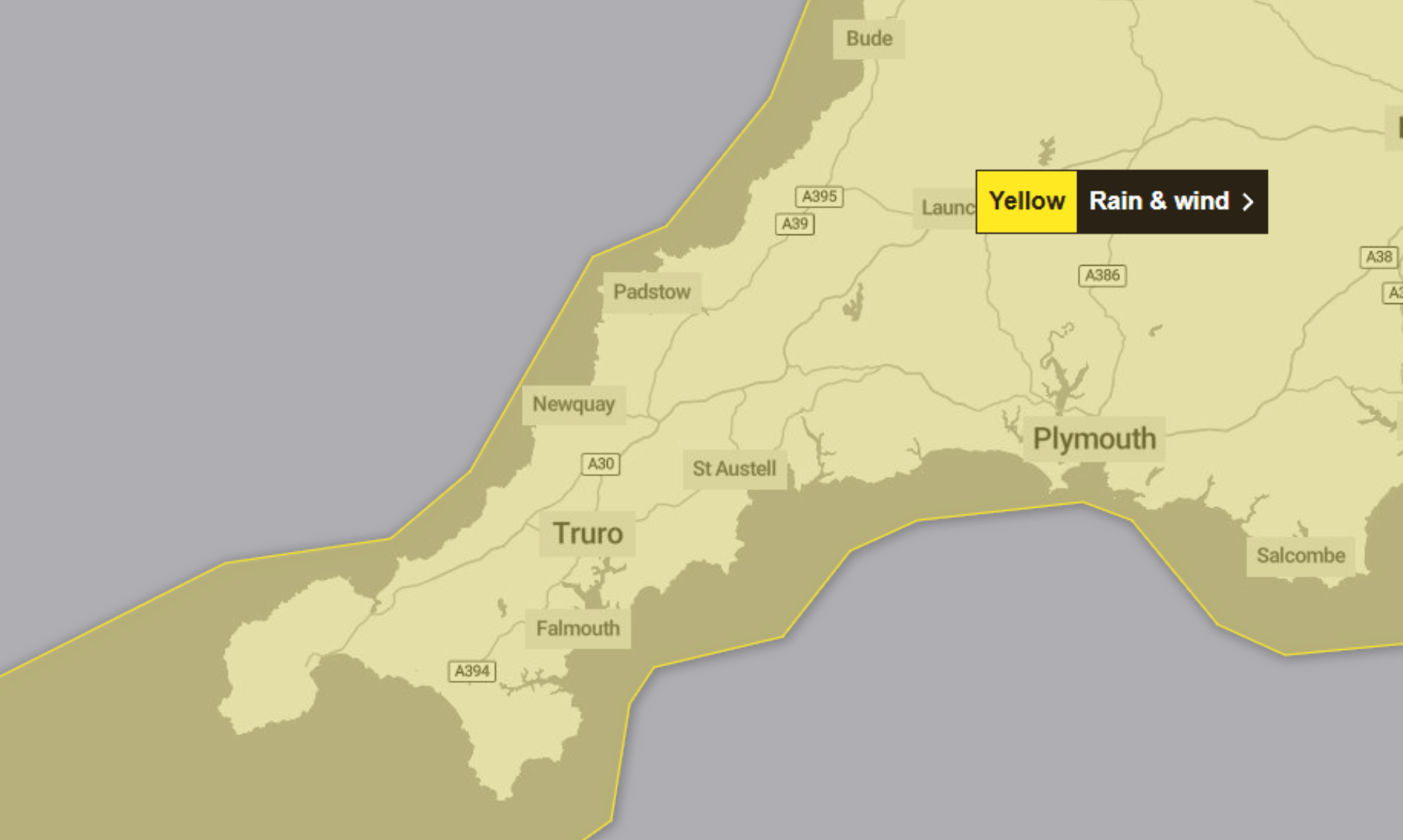
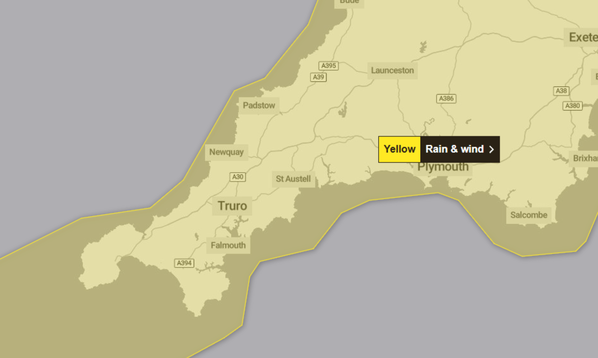
A yellow weather warning for rain and wind has been issued by the Met Office, covering parts of southwest England and south Wales from 02:00 on Friday 23rd January until 09:00 on Saturday 24th January.
The warning highlights the risk of flooding and disruption to travel as periods of heavy rain and strong winds move through the region.
What’s coming
Storm Ingrid, named by the Portuguese national weather service IPMA, is expected to bring spells of heavy rain and strong winds during Friday before conditions ease on Saturday morning.
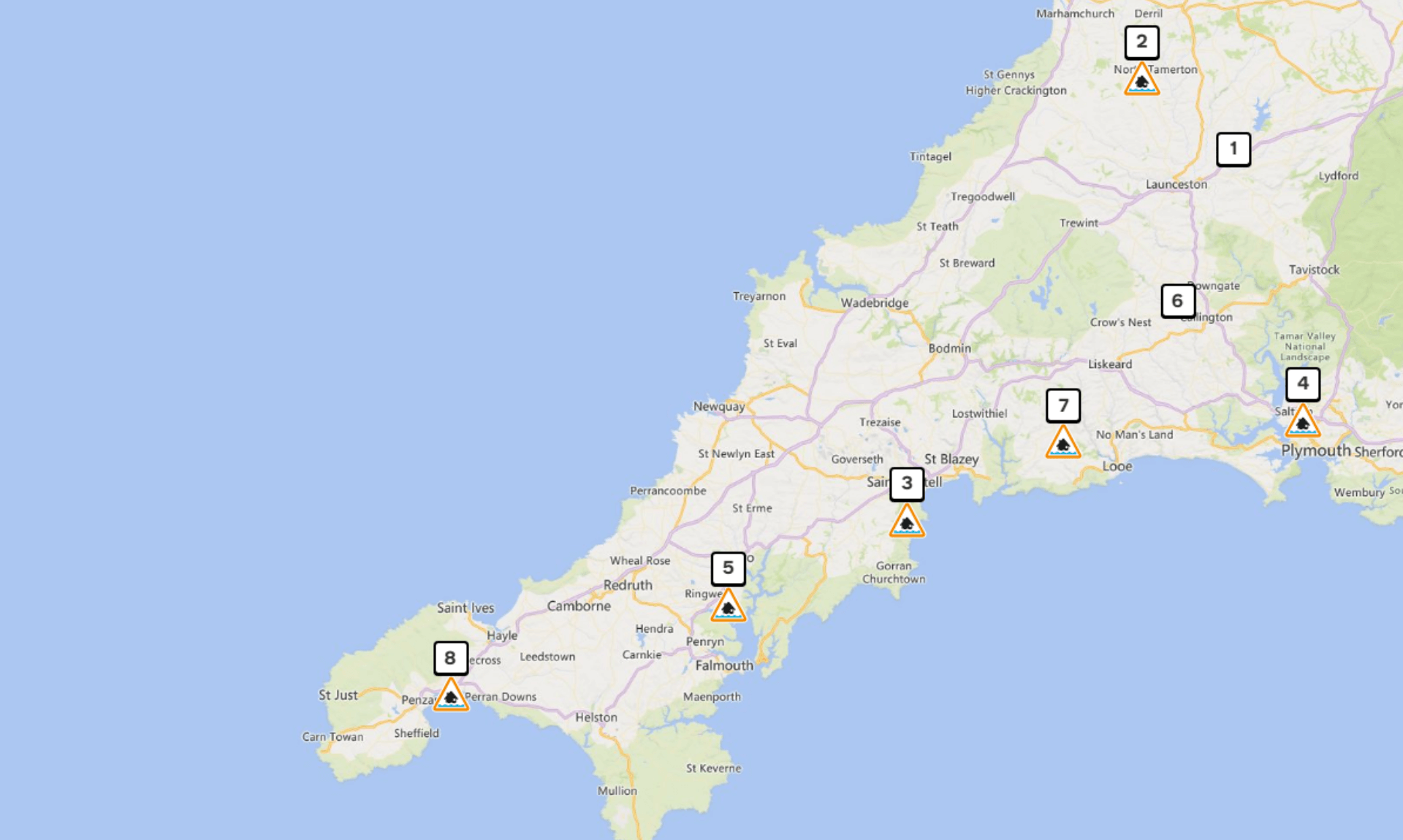
An initial band of rain early on Friday could bring a further 10 to 20 mm of rainfall in a few hours, falling on already saturated ground. After a drier spell, further bands of locally heavy rain and showers are forecast to push north through the afternoon, evening and overnight.
By Saturday morning, a further 15 to 20 mm of rain is expected across much of the region, with 30 to 40 mm possible in some places. With ground conditions already wet, this raises the likelihood of flooding.
Wind and coastal conditions
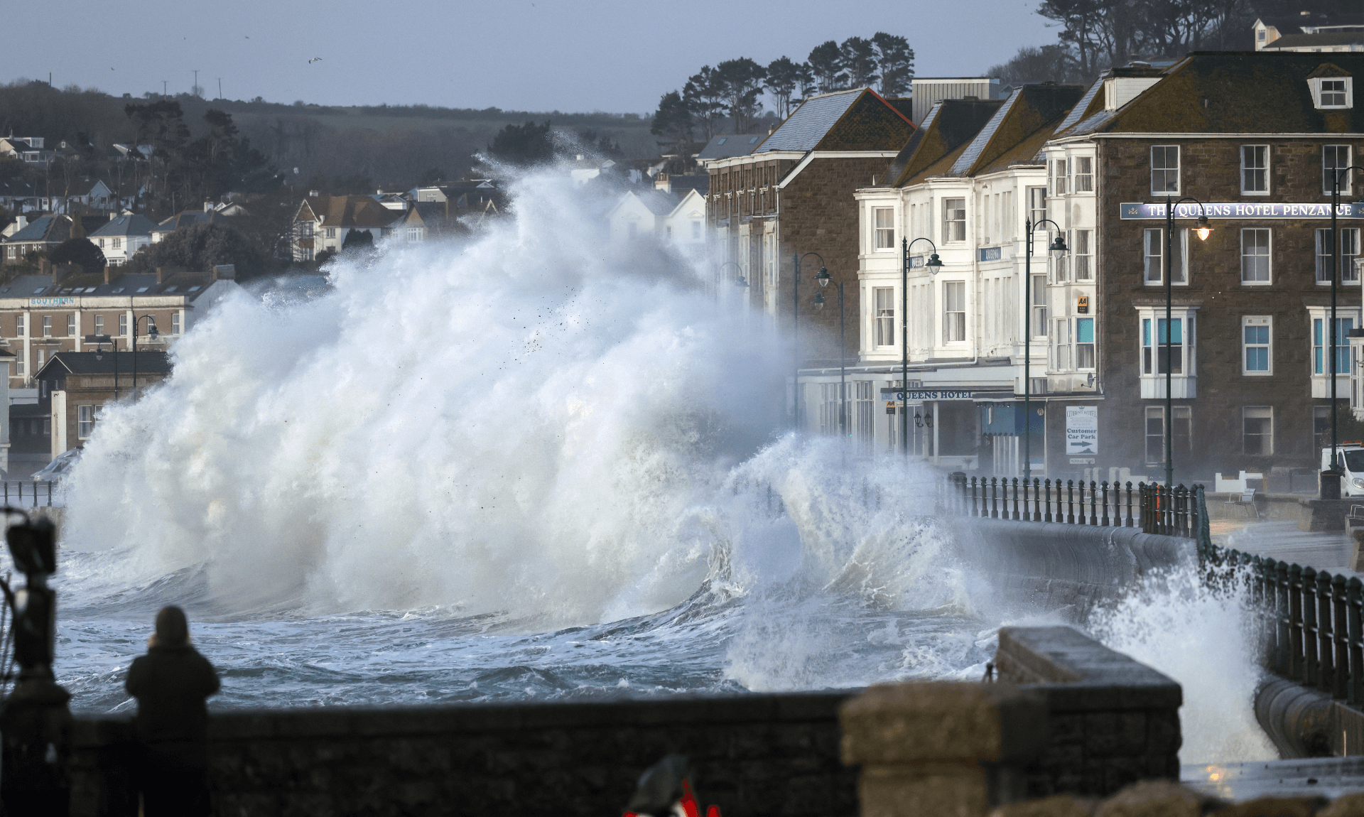
The second spell of rain is expected to be accompanied by strong winds and coastal gales, along with very large waves. Gusts of 45 to 50 mph are widely expected inland, with up to 60 mph possible near coasts.
Winds are forecast to peak during Friday evening before gradually easing overnight and into Saturday morning. Coastal routes, sea fronts and coastal communities are likely to be affected by spray and large waves.
Possible impacts
The Met Office says the following impacts are possible during the warning period:
-
A few homes and businesses could be flooded, with spray and flooding on roads
-
Delays to road, rail, air and ferry travel
-
Some bus and train services affected, with journeys taking longer
-
Short term loss of power and other services in some areas
Advice from the Met Office
People are advised to check whether their property could be at risk of flooding and consider preparing a flood plan and emergency flood kit.
Anyone travelling is encouraged to check road conditions or bus and train timetables and amend plans if needed. Preparing for possible power cuts by gathering torches, batteries and mobile phone power packs is also recommended.
Those near the coast are urged to be aware of large waves, which can be dangerous even from the shore. Care should be taken near cliffs, routes should be planned in advance, and dogs kept on leads. In an emergency, people should call 999 and ask for the Coastguard.
The Met Office also advises staying up to date with local forecasts, as weather warnings can change quickly.
Why the warning is yellow
The warning is classed as yellow due to a high likelihood of the weather occurring but a low overall impact.
Storm Ingrid Brings Heavy Rain and Gales to the South West
The South West of England is set for a spell of unsettled weather from Friday 23rd January to Tuesday 27th January, with heavy showers and strong winds expected across the region.
Friday 23rd January
Today is forecast to be cloudy as Storm Ingrid moves in, bringing outbreaks of heavy rain and strengthening winds through the morning. The rain is expected to clear to the north east by the afternoon, allowing some brighter and drier spells to develop. However, heavy showers are likely to follow.
It will be windy throughout the day, with coastal gales possible. The maximum temperature is forecast to reach 9°C.
Tonight
Frequent showers are expected to continue overnight, often heavy, particularly in the west. There may be some drier and clearer spells further east.
Strong winds will continue overnight, with coastal gales still possible. Temperatures are expected to fall to a minimum of 6°C.
Saturday
Saturday is expected to start damp, with heavy showers and strong winds continuing. Some brighter spells are possible in the east during the morning, but showers are forecast to become more widespread as the evening approaches.
The maximum temperature is again expected to reach 9°C.
Outlook for Sunday to Tuesday
Blustery showers are forecast to continue through Sunday. The unsettled weather is expected to persist into the start of the new week, with bands of rain bringing prolonged heavy downpours at times.
It will feel chillier, with overnight frost possible, and conditions are expected to remain often breezy through to Tuesday.
Share This Story, Choose Your Platform!
To keep up with the latest cornish news follow us below
Follow CornishStuff on Facebook - Like our Facebook page to get the latest news in your feed and join in the discussions in the comments. Click here to give us a like!
Follow us on Twitter - For the latest breaking news in Cornwall and the latest stories, click here to follow CornishStuff on X.
Follow us on Instagram - We also put the latest news in our Instagram Stories. Click here to follow CornishStuff on Instagram.
You Might Also Be Interested In


Don’t Miss What’s Happening in Cornwall
Join others in Cornwall by receiving the latest daily news in Cornwall, sent direct to your inbox.