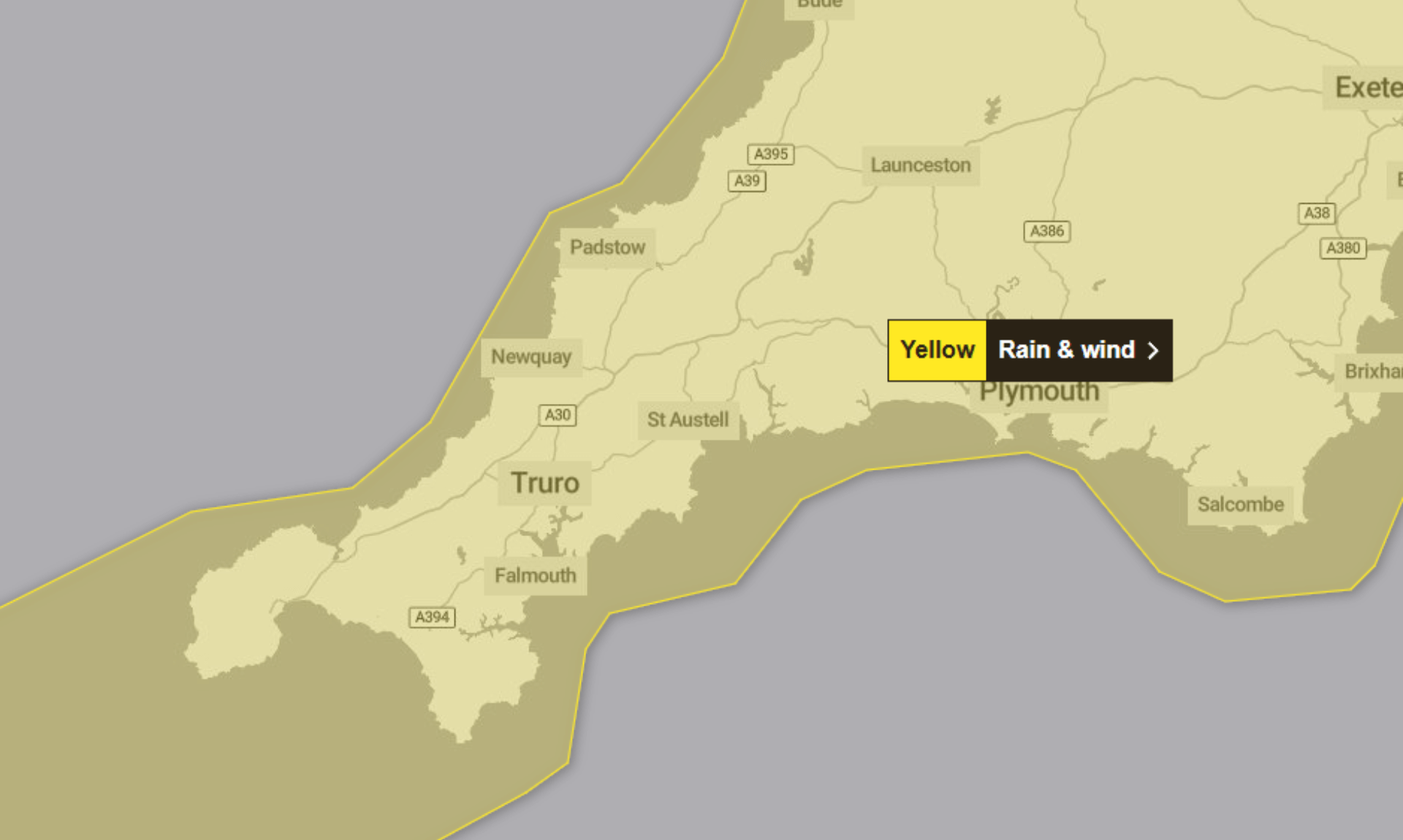
24/01/2026 – Weather in Cornwall – Yellow Weather Warning For Rain
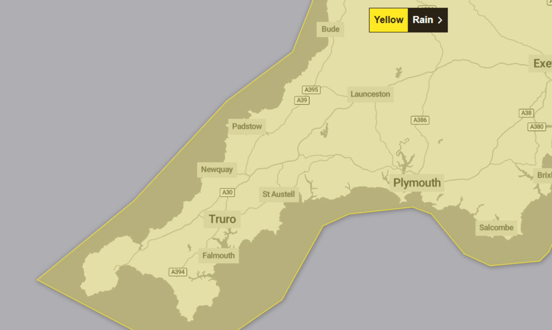
The Met Office has issued a yellow weather warning for rain, covering the period from 02:00 on Friday 23rd January through to 22:00 today, Saturday 24th January.
Further heavy rain through Saturday is expected to bring a risk of flooding and transport disruption in some areas.
What to Expect
The Met Office says spray and flooding on roads are likely, which could make journey times longer. A small number of roads may become impassable at times.
There is also a small chance that a few homes and businesses could be flooded. Some interruption to power supplies and other services is possible, while bus and train services may be affected, with delays likely.
Driving conditions could be difficult and, at times, dangerous, particularly during the heaviest showers.
Why the Rain Is a Concern
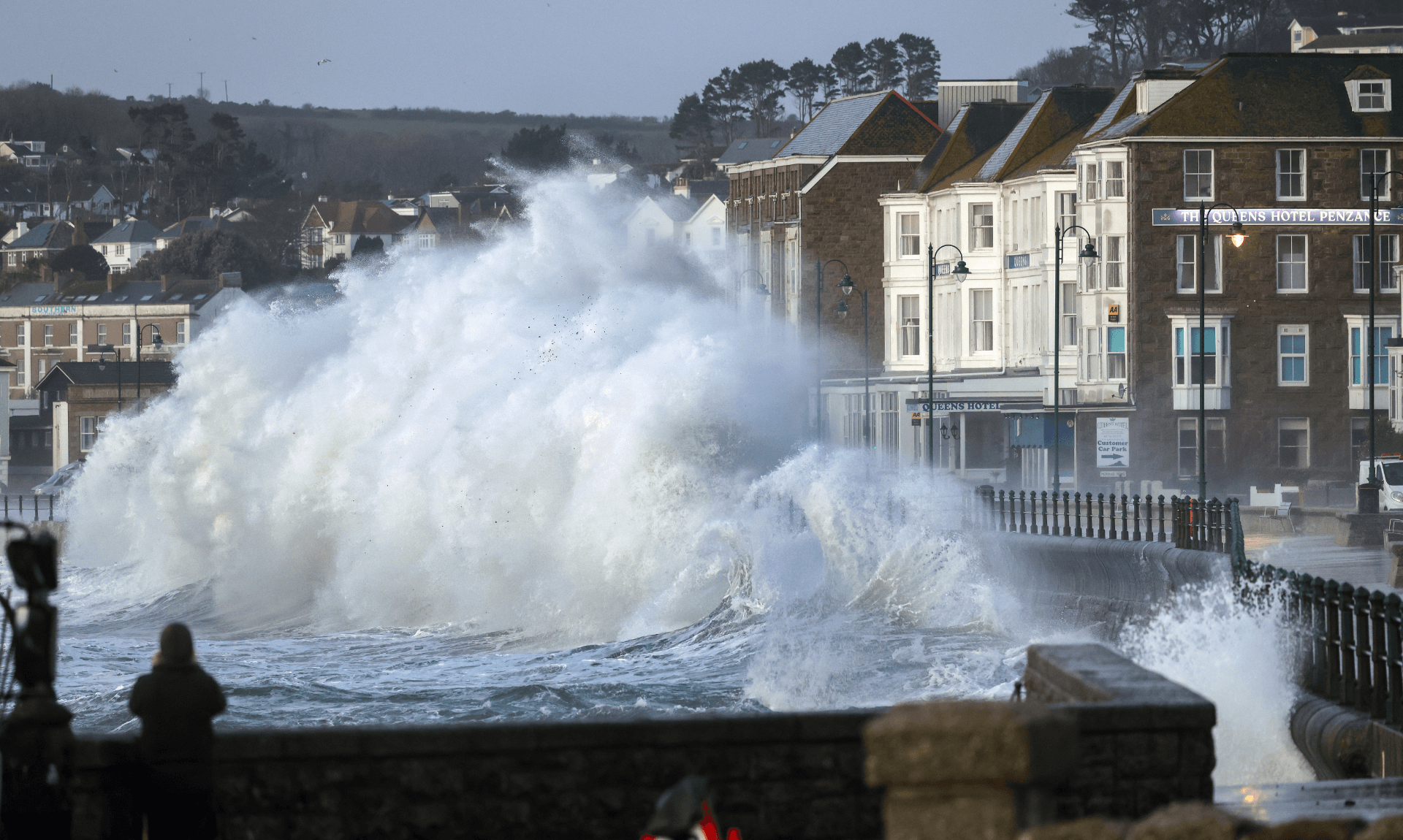
The unsettled weather is being driven by Storm Ingrid, which was named by the Portuguese Met Service. The system is expected to drift slowly northwards over the Celtic Sea during Saturday.
Bands of frequent heavy showers are forecast to move around the centre of the storm, occasionally merging into longer spells of rain. An additional 20 to 40mm of rainfall is expected in many places, with up to 50mm possible in a few exposed locations.
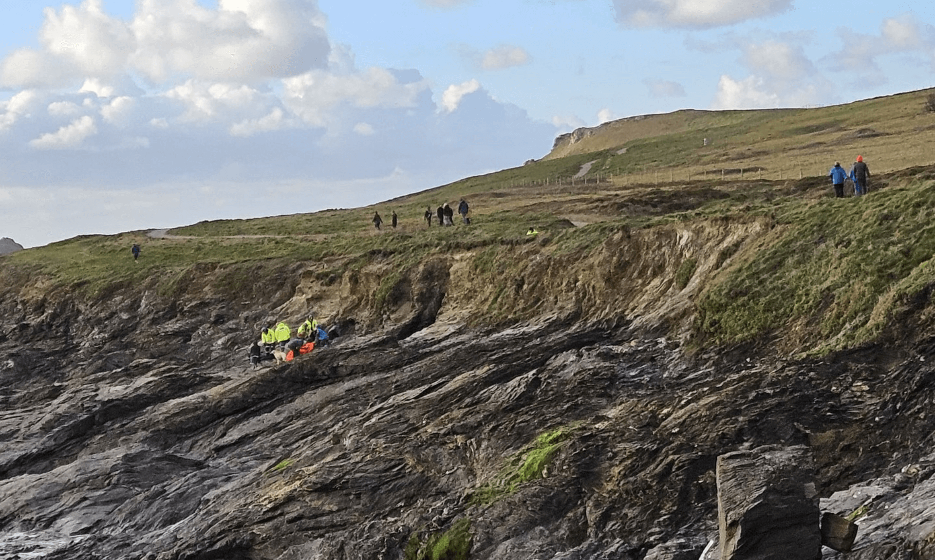
With ground conditions already saturated in many areas, even modest rainfall could lead to further flooding of roads and water flowing from fields. This may make driving conditions more challenging and increase the risk of roads becoming impassable.
Although winds are not expected to be as strong as on Friday, gusts approaching gale force during Saturday morning could worsen impacts at times, particularly along the English Channel coastline.
Advice From the Met Office
People are advised to check whether their property could be at risk of flooding and, if so, consider preparing a flood plan and an emergency flood kit.
Those planning to travel are encouraged to check road conditions and public transport timetables, allowing extra time or changing plans if needed.
The Met Office also recommends preparing in advance for possible power cuts by gathering torches, batteries, mobile phone power packs and other essential items.
Weather warnings can change quickly, and people are advised to stay up to date with the latest forecast for their area.
Why the Warning Is Yellow
The Met Office says the warning is classed as yellow because it has a high likelihood but a low impact, meaning disruption is possible but not expected to be widespread.
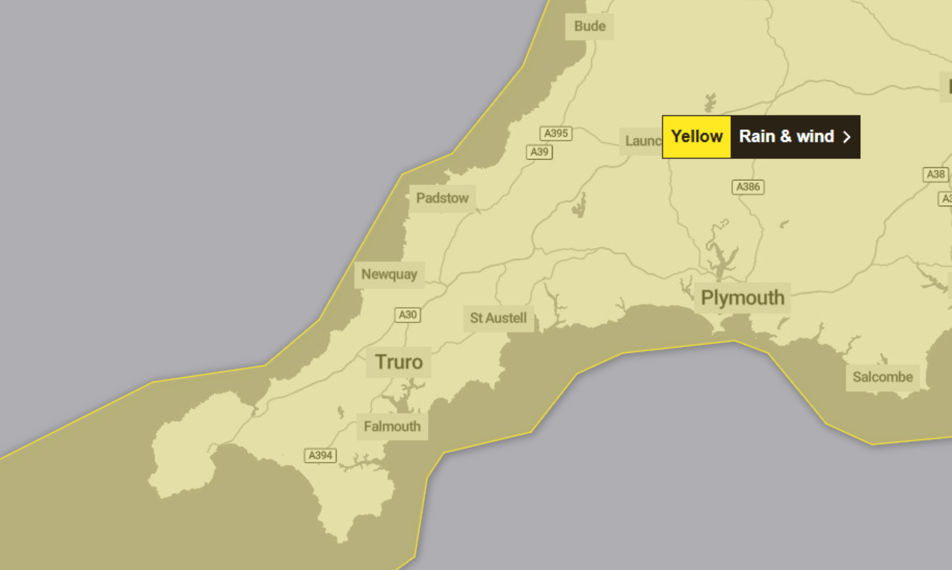
Heavy Rain, Gales and Hail Set to Hit South West England This Weekend
A spell of unsettled weather is set to affect South West England from today, Saturday 24th January, with heavy rain, strong winds and the risk of hail and lightning in places.
Saturday 24th January
Conditions today are expected to remain unsettled, with heavy showers continuing across much of the region. Strong winds will accompany the showers, although some brighter spells are possible in the east during the morning.
As the day goes on, showers are forecast to become more widespread into the evening. Some of these may bring hail and lightning. Temperatures are expected to reach a maximum of 10°C.
Tonight
Showers are expected to merge this evening and overnight, turning into longer spells of rain. There may be a drier period overnight, but further heavy downpours are forecast to arrive by dawn in the west.
Winds are expected to ease overnight, with temperatures dropping to around 3°C.
Sunday
Sunday is set to remain mixed, with rain and showers continuing through the day. While a few brief sunny spells are possible, conditions are expected to stay mostly cloudy.
Winds should be lighter than on Saturday, with maximum temperatures around 8°C.
Outlook: Monday to Wednesday
Monday is forecast to start dry, but cloud and rain are expected to move in from the west later in the day. Conditions will then turn wet and windy, with coastal gales likely on Tuesday.
The unsettled weather is expected to clear northwards into Wednesday, with temperatures feeling noticeably chillier as the week progresses.
Share This Story, Choose Your Platform!
To keep up with the latest cornish news follow us below
Follow CornishStuff on Facebook - Like our Facebook page to get the latest news in your feed and join in the discussions in the comments. Click here to give us a like!
Follow us on Twitter - For the latest breaking news in Cornwall and the latest stories, click here to follow CornishStuff on X.
Follow us on Instagram - We also put the latest news in our Instagram Stories. Click here to follow CornishStuff on Instagram.
You Might Also Be Interested In


Don’t Miss What’s Happening in Cornwall
Join others in Cornwall by receiving the latest daily news in Cornwall, sent direct to your inbox.