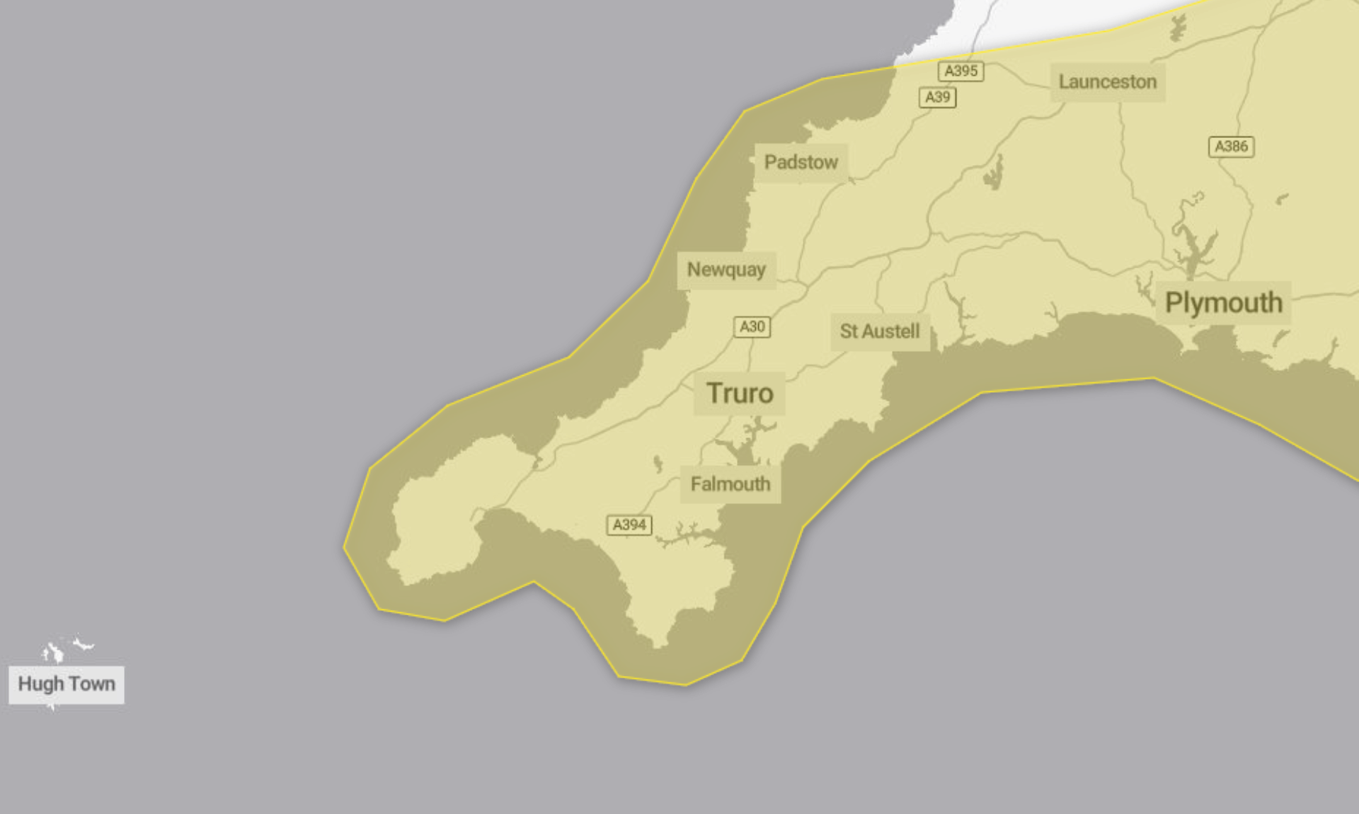
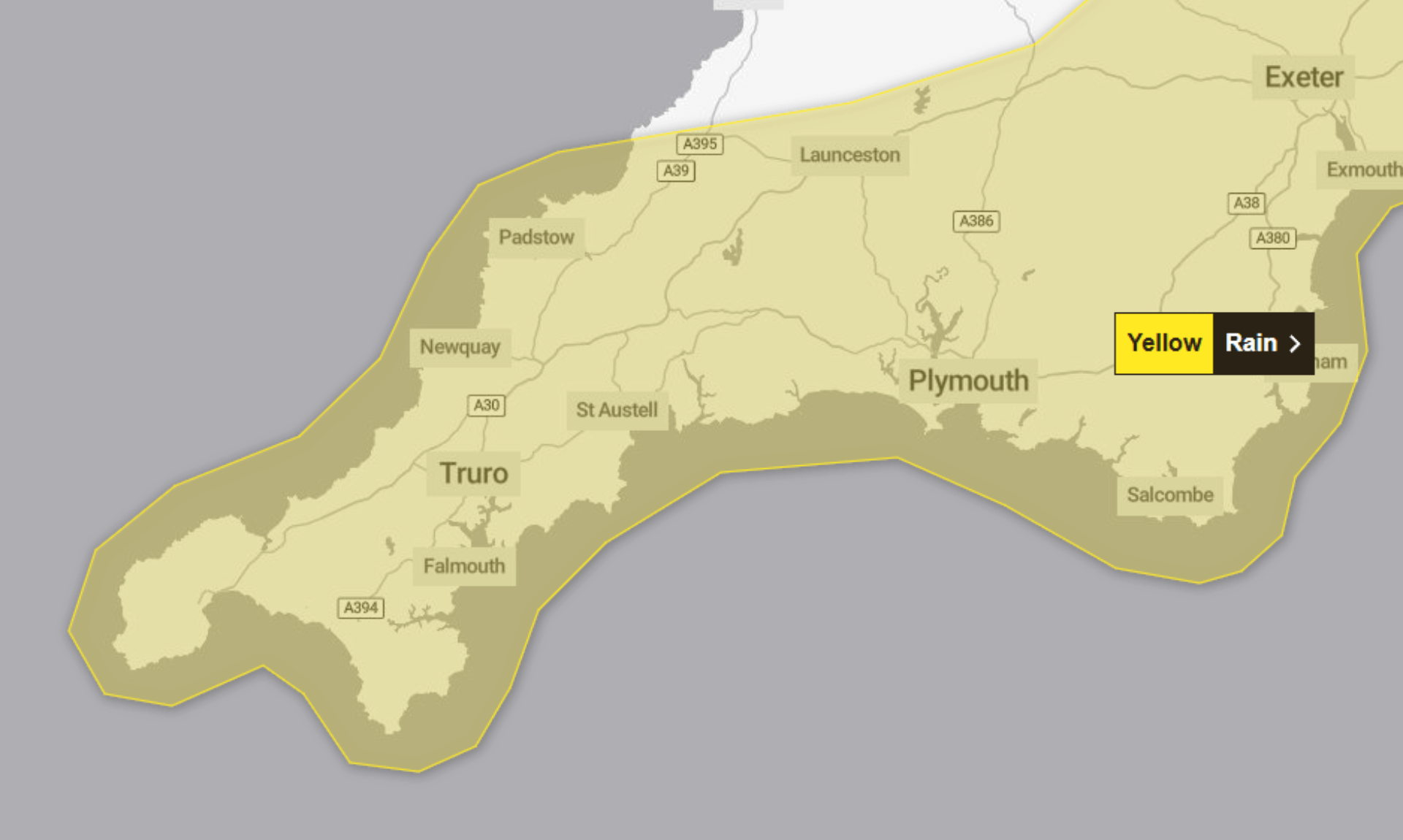
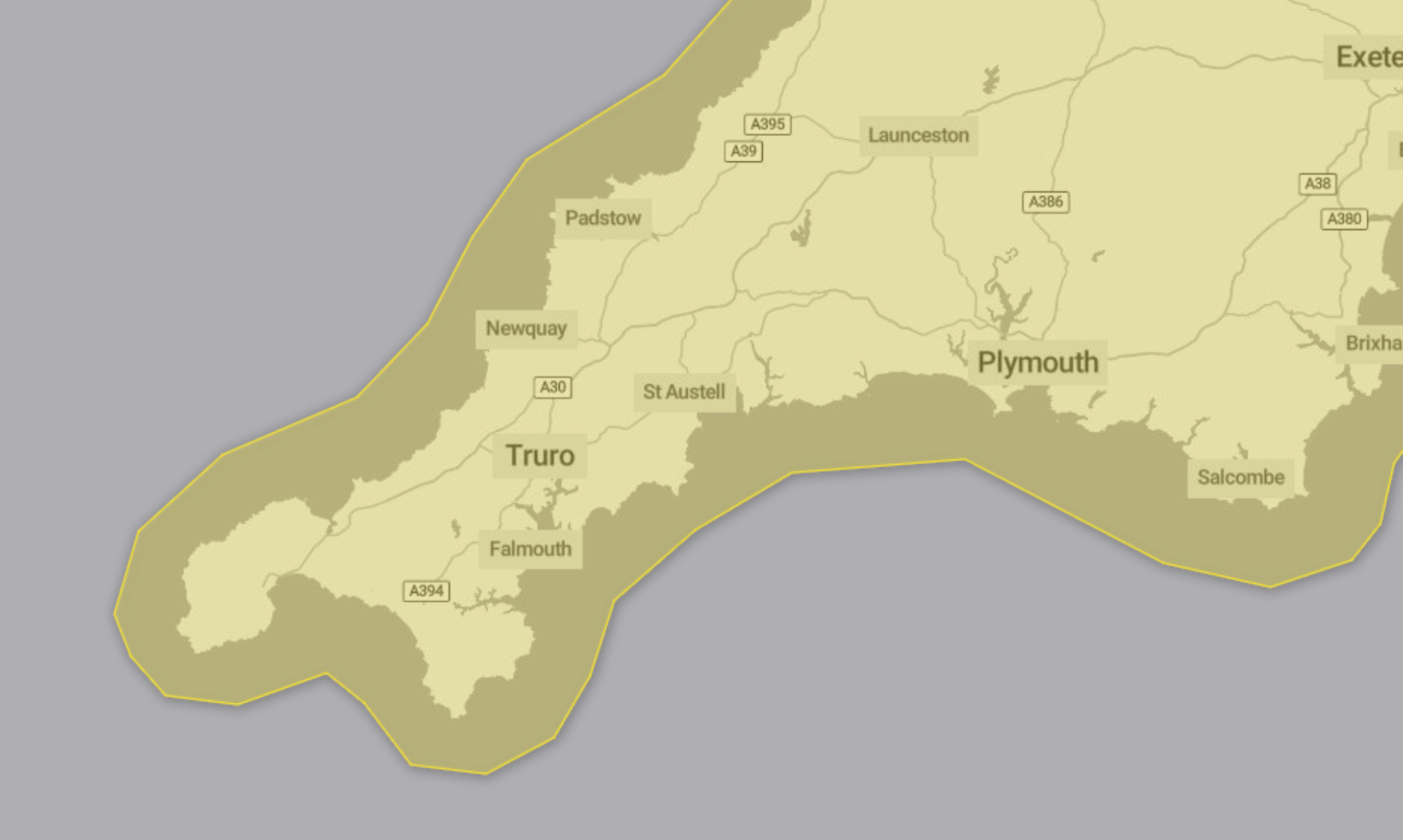
17/12/2025 – Weather in Cornwall – Yellow Weather Warning For Rain
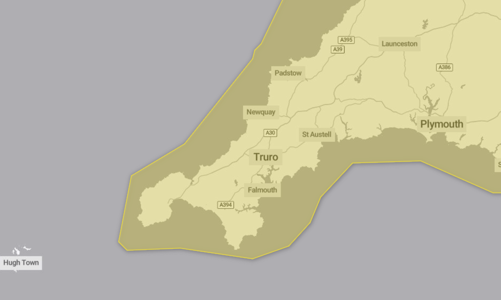
A yellow weather warning for rain has been issued by the Met Office, covering the period from 10:00 today, Wednesday 17th December, until 23:59 tonight.
Heavy rain is expected to cause travel disruption and possible flooding in parts of the warning area, especially following recent very wet weather.
What to Expect Today
The Met Office says a period of rain, heavy at times, will move slowly east across the region throughout Wednesday. The heaviest rainfall is expected over higher ground.
As a result, people may experience:
-
Bus and train services being affected, with longer journey times
-
Spray and flooding on roads causing delays
-
Some interruption to power supplies and other services
-
A small number of homes and businesses being flooded
Rainfall totals of 10 to 20mm are likely across much of the warning area. Higher ground could see significantly more, with 40 to 60mm possible over Dartmoor and the hills of south Wales.
The rain is expected to clear eastwards during Wednesday evening and into the early hours of Thursday.
Advice from the Met Office
People are being advised to check whether their property could be at risk of flooding and, if so, to consider preparing a flood plan and an emergency flood kit.
Those travelling are encouraged to check road conditions or bus and train timetables and adjust plans if needed.
The Met Office also advises preparing for potential power cuts by gathering items such as torches, spare batteries, a mobile phone power pack and other essential supplies.
Weather warnings can change quickly, and people are advised to stay up to date with the latest local forecasts.
Why the Warning Is Yellow
The Met Office says the yellow warning reflects a high likelihood of disruption but a low overall impact.
The warning remains in place until just before midnight tonight.
South West England weather forecast
Headline:
Unsettled, with heavy rain and strong winds.
Today:
A dull start as a rain band spreads eastwards, bringing widespread heavy downpours, accompanied by strong winds and perhaps coastal gales at times. Conditions worst felt in coastal regions and over higher ground. Travel disruption and localised flooding possible. Maximum temperature 12 °C.
Tonight:
Remaining unsettled through the evening as rain continues to spread eastwards, though some clear and drier spells emerging in the west overnight. A milder night than previous. Often breezy. Minimum temperature 5 °C.
Thursday:
A murky start, as further rain and strong winds push northeastwards through the day, bringing further heavy and prolonged downpours. Some brighter spells possible in the west through the afternoon. Maximum temperature 12 °C.
Outlook for Friday to Sunday:
Friday brings a brighter day with winds easing, though the odd shower remains possible. Unsettled again thereafter, as further bands of rain with strengthening winds move in from the west.
Updated:
Share This Story, Choose Your Platform!
To keep up with the latest cornish news follow us below
Follow CornishStuff on Facebook - Like our Facebook page to get the latest news in your feed and join in the discussions in the comments. Click here to give us a like!
Follow us on Twitter - For the latest breaking news in Cornwall and the latest stories, click here to follow CornishStuff on X.
Follow us on Instagram - We also put the latest news in our Instagram Stories. Click here to follow CornishStuff on Instagram.
You Might Also Be Interested In


Don’t Miss What’s Happening in Cornwall
Join others in Cornwall by receiving the latest daily news in Cornwall, sent direct to your inbox.