14/02/2026 – Weather in Cornwall

Ice Warning in Place as Wet and Windy Weather Sweeps Across the South West
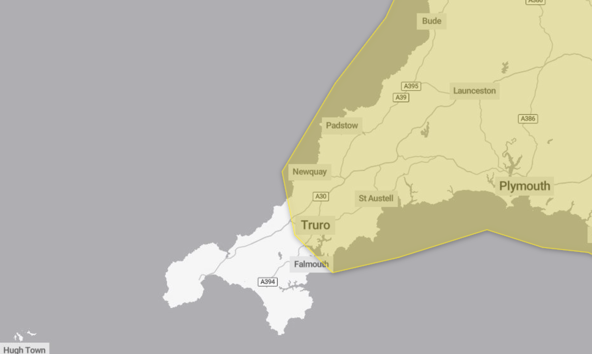
Residents across the South West are being urged to take care after a yellow weather warning for ice was issued, with forecasters warning of difficult travel conditions and a wet and windy spell on the way.
The warning, which ran from 5pm on Friday until 10am on Saturday, highlights the risk of icy surfaces leading to travel disruption and possible injuries from slips and falls.
Icy start to the weekend
According to the Met Office, a band of rain and sleet, with a little snow on hills, cleared southwards across England and Wales on Friday evening and overnight. As skies cleared, temperatures fell below freezing, creating a risk of ice forming on untreated roads, pavements and cycle paths.
Forecasters say some injuries from slips and falls are possible, along with icy patches on untreated surfaces.
People are advised to leave at least five minutes earlier than normal when heading out, reducing the need to rush and lowering the risk of accidents. Those travelling on foot are encouraged to use pavements along main roads, which are more likely to be less slippery. Cyclists are similarly advised to stick to main roads where possible.
Drivers are being urged to check road conditions before setting off, and to review bus and train timetables where necessary.
The warning is classed as yellow due to a medium likelihood of disruption but a low impact overall. The Met Office also advises residents to stay up to date with the latest forecasts, as warnings can change.
Sunshine before rain and gales
Saturday began with a frosty and cold but bright start across the region. Sunshine is expected to turn hazy during the morning, becoming increasingly overcast in the afternoon as cloud builds. Conditions are set to stay dry through the day with light winds. Maximum temperature is forecast to reach 7C.
Overnight, coastal gales are expected to develop as a band of rain and hill snow sweeps across the region. It will be a chilly evening for all, with a minimum temperature of 2C, although temperatures are set to rebound in the west after rain clears.
Blustery showers on Sunday
Rain is forecast to clear the far east early on Sunday. Brighter spells are expected to follow, mixed with blustery showers that could be heavy and perhaps locally thundery. It will be milder than Saturday, with a maximum temperature of 11C.
Looking ahead to Monday through to Wednesday, conditions are expected to remain unsettled. Monday will bring variable cloud and bright spells with occasional showers, some of which may be locally heavy. Tuesday is forecast to be drier and briefly colder again, with lighter winds. Rain may return on Wednesday.
Share This Story, Choose Your Platform!
To keep up with the latest cornish news follow us below
Follow CornishStuff on Facebook - Like our Facebook page to get the latest news in your feed and join in the discussions in the comments. Click here to give us a like!
Follow us on Twitter - For the latest breaking news in Cornwall and the latest stories, click here to follow CornishStuff on X.
Follow us on Instagram - We also put the latest news in our Instagram Stories. Click here to follow CornishStuff on Instagram.
You Might Also Be Interested In


Don’t Miss What’s Happening in Cornwall
Join others in Cornwall by receiving the latest daily news in Cornwall, sent direct to your inbox.