The Best Walks in Cornwall with a Café

There is a particular kind of Cornish walk that earns its reward at the end. A headland, a wooded valley or a slow stretch of estuary, and then a café waiting with a flat white and something warm out of the oven. Some of the walks below finish right beside one, others pass a café along the way, but every one of them gives you a good excuse to sit down at the end.
Every walk listed here comes from the brilliant iWalk Cornwall app, which we highly recommend. It is not a paid partnership. We just genuinely rate it for its GPS guidance, hand-written directions and the local detail packed into every route.
So whether you want a short loop to a beach café or a longer day out linking coast, creek or moor, there is something here to point you at your next outing. Distances and grades are a guide rather than a promise, and the practical notes come from iWalk Cornwall’s own route pages.
Your daily dose of Cornwall
News, events and goings on across the Duchy
1. Polzeath to St Enodoc Church

- Location: Polzeath, North Cornwall
- Parking: Polzeath Beach Car Park (PL27 6SS)
- Dog-Friendly: Yes, dogs allowed at Daymer Bay year-round, with seasonal restrictions on some beaches. The route crosses a golf course
- Café: Several options in Polzeath village
- iWalk Cornwall Route: Polzeath to St Enodoc Church
- Distance: 3.7 miles / 6 km
- Difficulty: Easy
- Highlights: St Enodoc Church, Daymer Bay, Trebetherick Point, Camel Estuary views
Walk Description: This circular walk starts near the surf at Polzeath and follows the coast past Greenaway and a string of small coves to the wide sands of Daymer Bay. Around Trebetherick Point the rocks turn a strange striped purple and green, with old shipwrecks showing at low water. The return cuts through the dunes past St Enodoc Church, buried so deep in sand for years that services were reached through a hole in the roof. Sir John Betjeman is buried in the churchyard.
2. Padstow to Harbour Cove

- Location: Padstow, North Cornwall
- Parking: Padstow harbour and town car parks (confirm postcode)
- Dog-Friendly: Yes, one stile beside a gate. Harbour Cove allows dogs year-round, with seasonal restrictions at St George’s Cove
- Café: Plenty of cafés in Padstow, a town built on its food
- iWalk Cornwall Route: Padstow to Harbour Cove
- Distance: 3.1 miles / 5 km
- Difficulty: Easy-Moderate
- Highlights: Padstow harbour, Prideaux Place, Camel Estuary views, sandy beaches at Harbour Cove and St George’s Cove
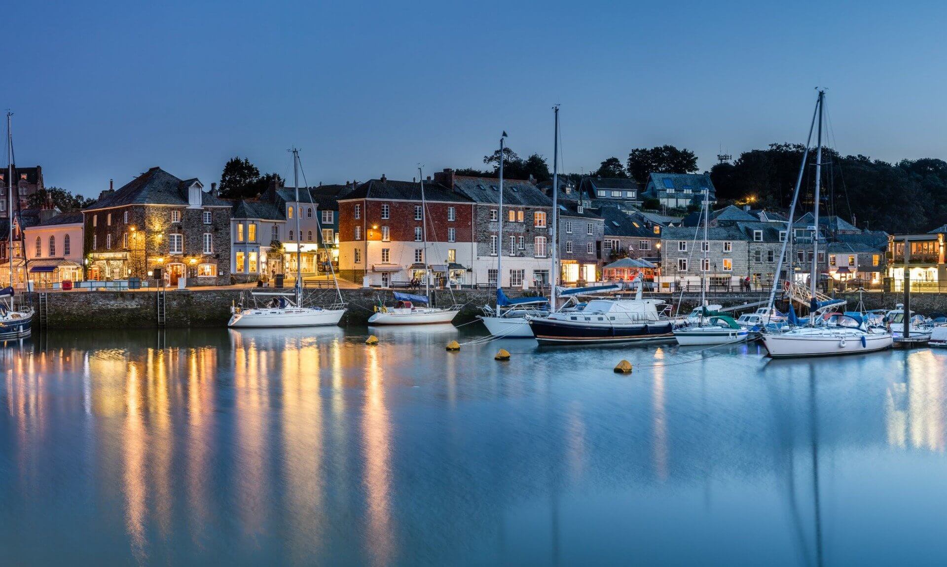
Walk Description: A route worth doing on an empty stomach. It threads through Padstow’s medieval streets to the church and the Elizabethan manor at Prideaux Place, climbs to big estuary views above Tregirls, then drops to a mile of sand at Harbour Cove and St George’s Cove before turning back into town. After heavy rain the wetland behind the dunes can spill onto the track, so wellies are worth a thought in winter.
3. Boscastle Headlands

- Location: Boscastle, North Cornwall
- Parking: Boscastle Harbour Car Park (PL35 0HD)
- Dog-Friendly: Yes, one stone stile that a less athletic dog may need help over
- Café: The Harbour Light, or the National Trust café in the old pilchard cellars on the harbour, open to non-members
- iWalk Cornwall Route: Boscastle Headlands
- Distance: 3.3 miles / 5.3 km
- Difficulty: Moderate
- Highlights: Pentargon waterfall, Willapark lookout, Forrabury Common, harbour views
Walk Description: A climb out to the Pentargon waterfall and the Willapark coastguard lookout, with the harbour and village laid out below from the Panoramic Path and Penally Hill. There is a medieval field system on Forrabury Common and an ancient wayside cross by the church. Local legend says the village women once lined the cliffs in red cloaks to fool a French ship into thinking it faced a wall of redcoats.
Your daily dose of Cornwall
News, events and goings on across the Duchy
4. Tintagel, Church and Castle

- Location: Tintagel, North Cornwall
- Parking: Tintagel Visitor Centre Car Park (PL34 0AJ)
- Dog-Friendly: Yes, one manageable stile with a gate alongside
- Café: Tea rooms and cafés throughout Tintagel village
- iWalk Cornwall Route: Tintagel, Church and Castle
- Distance: 2.4 miles / 3.9 km
- Difficulty: Easy-Moderate
- Highlights: Tintagel Castle, Merlin’s Cave, Old Post Office, St Materiana’s Church
Walk Description: Short, but stacked with history. The route takes in Tintagel Castle and Merlin’s Cave, King Arthur’s Great Halls and the Old Post Office, with a clifftop view over the castle and island from Barras Nose, and finishes at the ancient church of St Materiana. The village runs on cream teas and quirky shops. A footbridge near the sea is being rebuilt after flood damage, so follow the signs and use the bridge by the café while the work is on.
5. Bude Canal and Coast

- Location: Bude, North Cornwall
- Parking: The Crescent Car Park, Bude (confirm postcode)
- Dog-Friendly: Yes, no stiles and surfaced paths, so buggy and wheelchair friendly. Summerleaze allows dogs year-round, Crooklets seasonally
- Café: The Riverlife café by the canal, plus plenty more in town
- iWalk Cornwall Route: Bude Canal and Coast
- Distance: 3.9 miles / 6.3 km
- Difficulty: Easy
- Highlights: Bude Canal, tidal Sea Pool, Bude Castle, Summerleaze and Crooklets beaches
Walk Description: A flat figure-of-eight that tells the story of the canal built to carry lime-rich sand inland when even a reported 4,000 horses a day could not shift enough of it. You pass the historic tidal Sea Pool, Bude Castle and the famously underwhelming Bude Tunnel, with herons and egrets along the River Neet. It splits neatly into a 2 mile and a 1.7 mile loop if you want less.
6. Eden Project

- Location: Bodelva, near St Austell, Mid Cornwall
- Parking: Eden Project (PL24 2SG), starting from the outer Cherry car park
- Dog-Friendly: Yes, no stiles and easy going, with a dog-friendly café. Some on-lead walking beside roads
- Café: The Eden Coffee House, which can be visited without an entry ticket
- iWalk Cornwall Route: Eden Project
- Distance: 2.2 miles / 3.6 km
- Difficulty: Easy
- Highlights: Wildflower meadows, biomes, china clay and geothermal heritage
Walk Description: A loop through a granite landscape mined first for tin, then china clay, and now tapped for the geothermal heat that warms the biomes. The wildflowers in early summer are the draw, and it folds neatly into a day at Eden. The car park gates shut when Eden closes, which is earlier in winter, and the site shuts for a few days at a time in the new year for maintenance, so check before you drive over.
Your daily dose of Cornwall
News, events and goings on across the Duchy
7. Lanhydrock Gardens

- Location: Lanhydrock, near Bodmin, Mid Cornwall
- Parking: Lanhydrock National Trust Car Park (PL30 5AD)
- Dog-Friendly: Yes, no stiles. The parkland is occasionally grazed and dogs are not allowed in the formal gardens or house
- Café: Two National Trust cafés, one by the house and one near the car park
- iWalk Cornwall Route: Lanhydrock Gardens
- Distance: 3.2 miles / 5.1 km
- Difficulty: Easy-Moderate
- Highlights: Lanhydrock House and gardens, River Fowey woodland, bluebells, autumn fungi
Walk Description: A gentle circuit through the gardens and along the River Fowey, with picnic spots, bluebells in spring and fungi in autumn. You get the formal gardens, the Higher Gardens with their ornamental trees, and the long vista to the gatehouse across the parkland. Add the house if you have time, with its opulent rooms and vast Victorian kitchens. Two cafés mean the timing of a brew is up to you.
8. Trelissick

- Location: Feock, near Truro, Mid Cornwall
- Parking: Trelissick National Trust Car Park (TR3 6QL)
- Dog-Friendly: Yes, no stiles. On leads in the parkland and woods, and not allowed in the formal gardens
- Café: National Trust café, open to non-members without admission
- iWalk Cornwall Route: Trelissick
- Distance: 4.7 miles / 7.6 km
- Difficulty: Easy-Moderate
- Highlights: Creeks of the River Fal, Trelissick House and gardens, King Harry Ferry views
Walk Description: A figure-of-eight along the creeks of the Fal through the 300-acre estate around Trelissick House, with the King Harry Ferry crossing the river below. The National Trust café at the centre is open without paying for the gardens, and there are public barbecues down at Roundwood Quay if you bring your own charcoal.
9. Mevagissey to Portmellon

- Location: Mevagissey, Mid Cornwall
- Parking: Willow Car Park, Mevagissey (confirm postcode)
- Dog-Friendly: Yes, though a couple of stiles may need a dog lifting over. Seasonal restrictions at Portmellon beach
- Café: Several cafés around Mevagissey harbour
- iWalk Cornwall Route: Mevagissey to Portmellon
- Distance: 3.4 miles / 5.4 km
- Difficulty: Moderate
- Highlights: Mevagissey harbour, Polkirt Hill views, West Bodrugan Woods, Portmellon
Walk Description: From the busy fishing port of Mevagissey, the route climbs Polkirt Hill for views back over the harbour, then drops into the Portmellon valley and the West Bodrugan Woods nature reserve before reaching the beachside village of Portmellon, where boats have been built for centuries and still are. Mevagissey itself has the cafés stacked tight around the harbour.
Your daily dose of Cornwall
News, events and goings on across the Duchy
10. Charlestown to Porthpean

- Location: Charlestown, near St Austell, Mid Cornwall
- Parking: Charlestown Car Park (confirm postcode)
- Dog-Friendly: Yes, no stiles. Year-round dog bans on Charlestown and Duporth beaches, seasonal at Porthpean
- Café: Cafés around the historic harbour at Charlestown
- iWalk Cornwall Route: Charlestown to Porthpean
- Distance: 2.9 miles / 4.7 km
- Difficulty: Moderate
- Highlights: Charlestown harbour and tall ships, shipwreck museum, Porthpean and Duporth beaches
Walk Description: A walk between the sheltered cove at Porthpean and the Georgian port of Charlestown, built to ship copper and then china clay, and now better known as a film set for Poldark and Hollywood, with tall ships often moored at the quay. There is a shipwreck museum at Charlestown and a second sandy cove at Duporth along the way.
11. Lizard to Kynance Cove

- Location: The Lizard Peninsula, West Cornwall
- Parking: Lizard Village Car Park (confirm postcode)
- Dog-Friendly: Yes, stiles fine for larger dogs. Seasonal restrictions at Kynance Cove
- Café: The café overlooking Kynance Cove
- iWalk Cornwall Route: Lizard to Kynance Cove
- Distance: 3.2 miles / 5.1 km
- Difficulty: Moderate
- Highlights: Kynance Cove, serpentine rock, the county flower, Cornish choughs
Walk Description: This shorter version of a Lizard classic runs from the village out to one of the most photographed coves in Britain, past sea-polished serpentine rock, the county flower and the odd flash of a Cornish chough. The path across the top of the cove crosses some wobbly boulders, so a walking pole helps, or you can take the high-tide path and double back down the track to reach the café.
12. St Agnes Beacon and Wheal Coates

- Location: St Agnes, West Cornwall
- Parking: Beacon Drive Car Park, St Agnes (confirm postcode)
- Dog-Friendly: Yes, one stile beside a gate and one field sometimes used for cattle
- Café: The beach café at Chapel Porth, which the coast path passes
- iWalk Cornwall Route: St Agnes Beacon and Wheal Coates
- Distance: 3 miles / 4.9 km
- Difficulty: Easy-Moderate
- Highlights: Wheal Coates engine houses, St Agnes Beacon, panoramic coast views
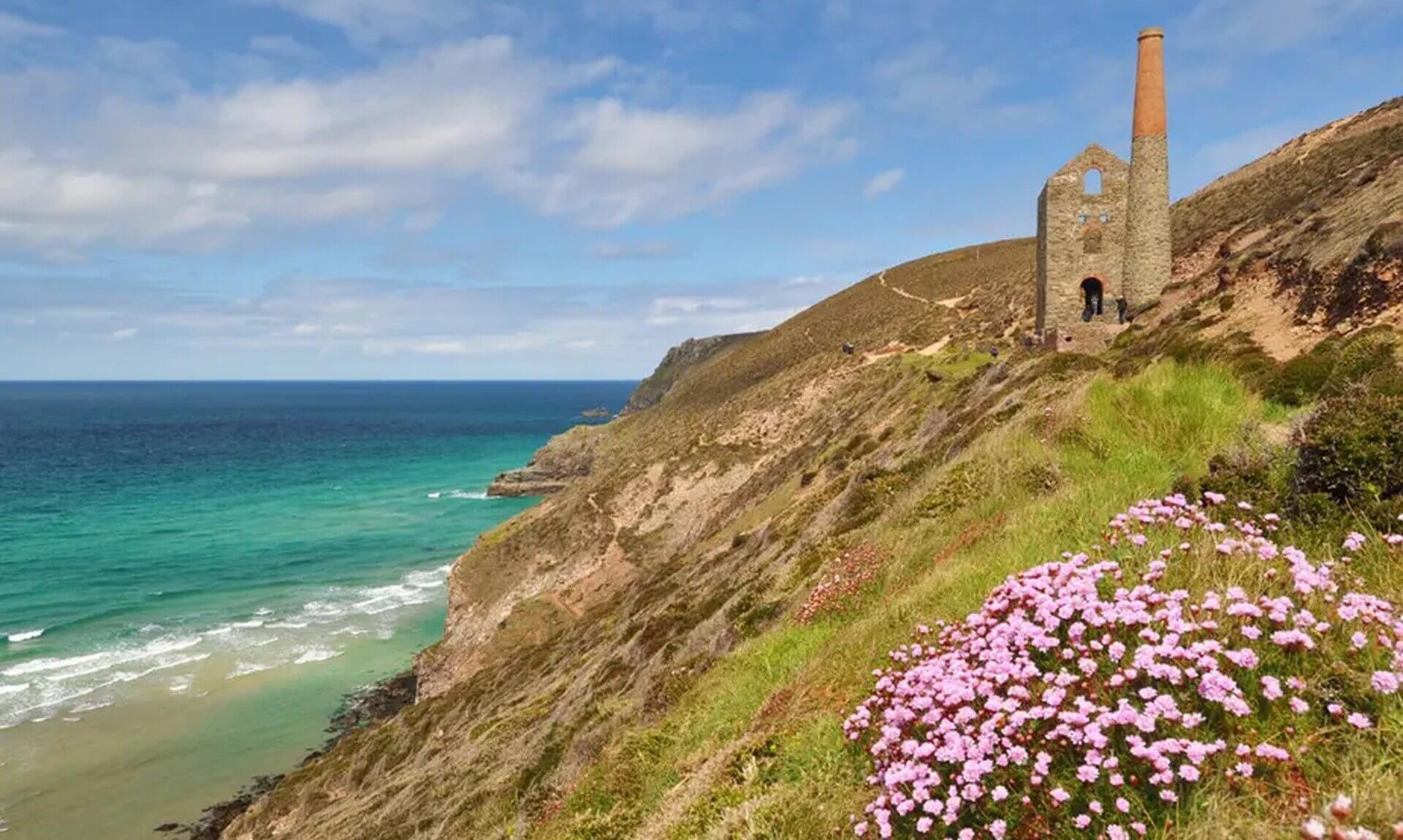
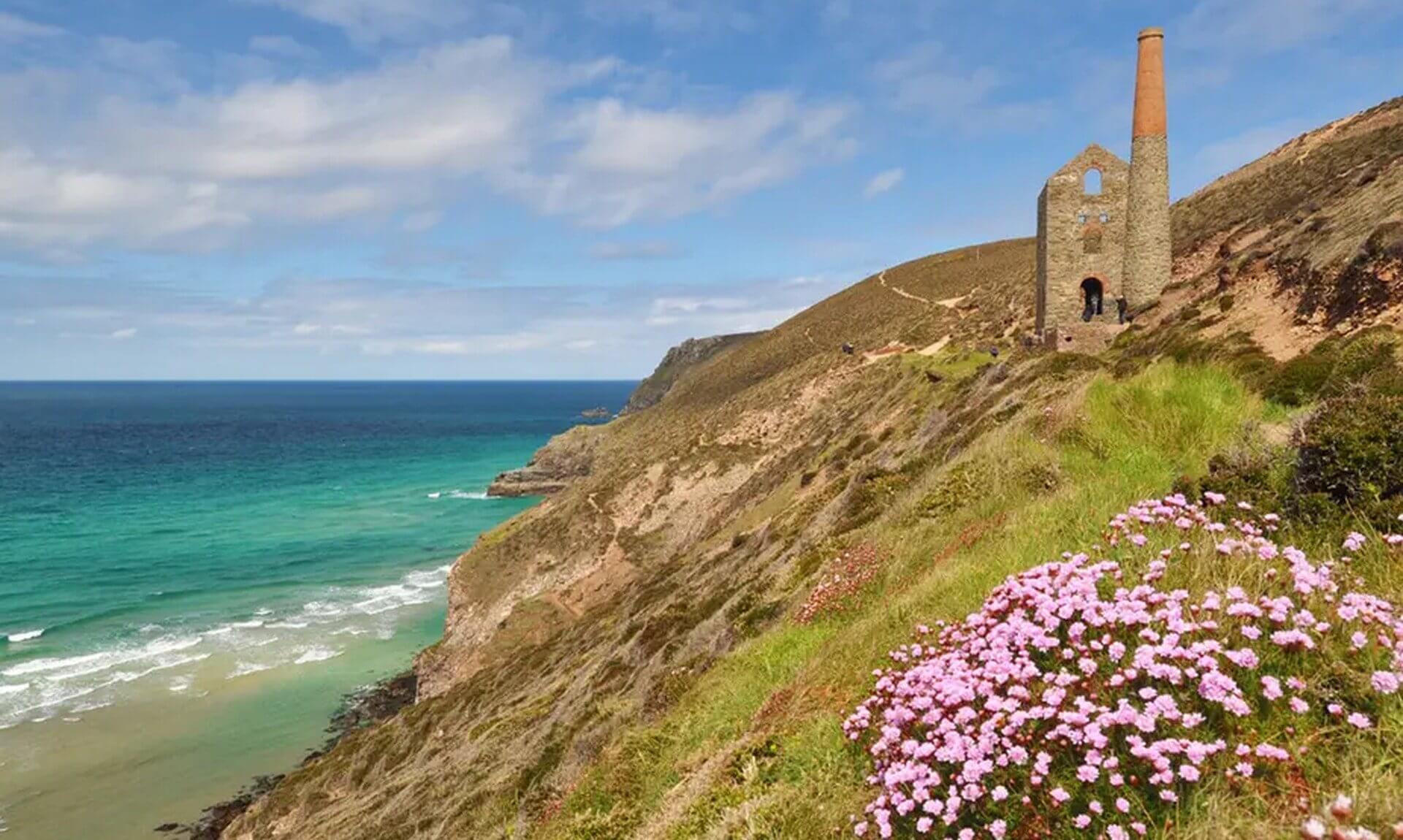
Walk Description: A loop between St Agnes Head and the cliff-edge engine houses of Wheal Coates, taking in the Beacon and a 360-degree view that on a clear day reaches along the coast to Porthtowan and Portreath. This is bellyboarding and Bolster Day country, with a strong local art scene, and the beach café down at Chapel Porth is the reward, ice cream included.
Your daily dose of Cornwall
News, events and goings on across the Duchy
13. Porthgwarra to Minack

- Location: Porthgwarra, West Cornwall
- Parking: Porthgwarra Cove Car Park (confirm postcode)
- Dog-Friendly: Yes, stone-step stiles most dogs manage. Half a mile is on a narrow lane that gets busy in peak season
- Café: A café at Porthgwarra Cove, with the Minack’s own café at the theatre
- iWalk Cornwall Route: Porthgwarra to Minack
- Distance: 3.1 miles / 5 km
- Difficulty: Moderate
- Highlights: Minack Theatre, St Levan’s church and holy well, Porthchapel beach, the Porthgwarra rock tunnel
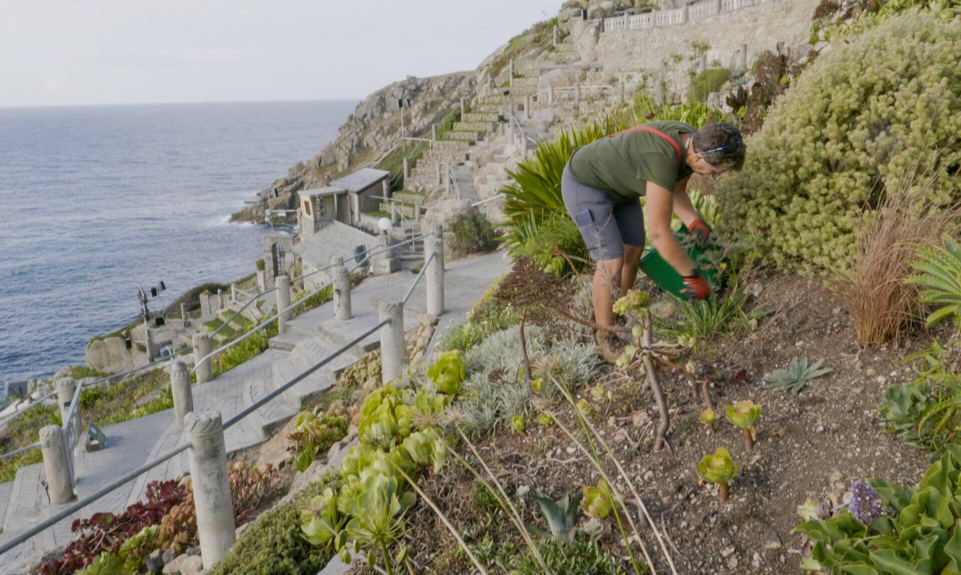
Walk Description: A walk up to the Minack Theatre by way of St Levan’s church and holy well and the sandy beach at Porthchapel, starting from Porthgwarra, where the cove is reached through a tunnel cut by local miners. On a good day the views take in the Wolf Rock and Longships lighthouses and the Isles of Scilly, with seals, choughs and birds of prey to look out for. The descent to Porthgwarra goes over some large boulders.
14. Marazion to Penzance

- Location: Marazion, West Cornwall
- Parking: Marazion seafront car parks (confirm postcode)
- Dog-Friendly: Yes, mostly paved with no stiles. A summer dog ban on the main beach means staying on the coast path
- Café: Cafés in both Marazion and Penzance
- iWalk Cornwall Route: Marazion to Penzance
- Distance: 6 miles / 9.7 km
- Difficulty: Easy
- Highlights: St Michael’s Mount, Mount’s Bay, Tremenheere Sculpture Gardens diversion
Walk Description: A flat circuit around Mount’s Bay with St Michael’s Mount holding the view for most of the way, and the chance, after a big storm and a very low tide, to see the stumps of the prehistoric forest that once stood here. You can divert to the Tremenheere Sculpture Gardens or cross to the Mount after the walk. It is mostly paved, so it suits wheels with a few small adaptations.
15. Land’s End

- Location: Land’s End, West Cornwall
- Parking: Land’s End Car Park (TR19 7AA)
- Dog-Friendly: Yes, no stiles, just some free-range geese at the farm
- Café: The First and Last café at the Land’s End complex, with more options at nearby Sennen Cove
- iWalk Cornwall Route: Land’s End
- Distance: 3.9 miles / 6.3 km
- Difficulty: Easy-Moderate
- Highlights: Cliffs and rock arches, early-summer wildflowers, seals and choughs
Walk Description: The walk, rather than the car park, is the best way to see Land’s End, taking in the cliffs and rock arches either side of the headland, the wildflowers in early summer and wildlife including seals, choughs and birds of prey. A short section of path was closed for repairs at the time of writing, so follow the signed diversion.
Your daily dose of Cornwall
News, events and goings on across the Duchy
16. Looe Woodland, River and Coast

- Location: Looe, Southeast Cornwall
- Parking: West Looe / Millpool Car Park (confirm postcode)
- Dog-Friendly: Yes, one stile next to a usually-open gate, and no livestock on the route
- Café: Cafés in East Looe
- iWalk Cornwall Route: Looe woodland, river and coast
- Distance: 3 miles / 4.8 km
- Difficulty: Easy-Moderate
- Highlights: Kilminorth Woods, the 6th-century Giant’s Hedge, River Looe, Looe Island
Walk Description: A walk that follows the West Looe river down through the mature oak woodland of Kilminorth, past the 6th-century Giant’s Hedge, to the point where the river meets the Atlantic beside one of Cornwall’s medieval ports. Look for herons, egrets and kingfishers on the water, and you can add a trip out to Looe Island. The woodland paths get slippery after rain.
17. Polperro Harbour and Headlands

- Location: Polperro, Southeast Cornwall
- Parking: Polperro (Crumplehorn) Car Park (confirm postcode)
- Dog-Friendly: Yes, no stiles and no livestock on the route
- Café: Tearooms and cafés through Polperro village
- iWalk Cornwall Route: Polperro harbour and headlands
- Distance: 2.9 miles / 4.7 km
- Difficulty: Moderate
- Highlights: Polperro harbour, the net loft, Victorian sea pool, smuggling heritage
Walk Description: A figure-of-eight around the old fishing village and its headlands, past the net loft above the harbour, the Victorian sea pool that fills on calm summer days, the site of the medieval chapel and the harbourmaster’s route to the lighthouse. The village made its name on smuggling, and the heritage museum tells that story. The narrow streets behind the quay are lined with tearooms.
18. Danescombe Valley and Cotehele

- Location: Calstock, Southeast Cornwall
- Parking: Cotehele National Trust Car Park (PL12 6TA)
- Dog-Friendly: Yes, no stiles and no livestock. The footbridge over the Danescombe river gets slippery after rain
- Café: National Trust café on Cotehele Quay, open to non-members without admission
- iWalk Cornwall Route: Danescombe Valley
- Distance: 2.5 miles / 4 km
- Difficulty: Moderate
- Highlights: Cotehele House, Victorian gardens, limekilns, River Tamar views, bluebells and orchids
Walk Description: A loop from Cotehele Quay into the broadleaf woods of the Danescombe Valley, where bluebells and orchids come up in spring and fungi push through the leaves in autumn. The estate gives you a well-preserved Tudor mansion, Victorian gardens with a medieval dovecot, old limekilns and engine houses, and views along the River Tamar.
Your daily dose of Cornwall
News, events and goings on across the Duchy
19. Minions and the Cheesewring

- Location: Minions, Bodmin Moor, Southeast Cornwall
- Parking: Minions Car Park (confirm postcode)
- Dog-Friendly: Yes, no stiles, but dogs go on a short lead on the open moor between March and July, and sheep and ponies graze freely
- Café: A tearoom in Minions, the highest village in Cornwall
- iWalk Cornwall Route: Minions and the Cheesewring
- Distance: 3.8 miles / 6.8 km
- Difficulty: Moderate
- Highlights: The Hurlers stone circles, the Cheesewring, Stowe’s Hill views, Phoenix mine engine houses
Walk Description: Up on Bodmin Moor, this one takes in the Hurlers stone circles and cairns, the balanced granite of the Cheesewring on Stowe’s Hill, and the engine houses of the Phoenix United and South Phoenix mines, with wide moorland views and the quieter woods around Henwood. The paths fade in places on the open moor, so the app’s map screen is the sensible way to keep your line.
The Reward at the End
Every one of these is worth doing for the walk alone, with the café as the excuse. By following the routes on the iWalk Cornwall app you get hand-written directions, GPS guidance that warns you if you wander off-route, and a wealth of local history along the way. Once a walk is downloaded it keeps working with no phone or wifi signal, which matters on the parts of the coast and moor where the bars on your phone vanish.
As we said, this is not a paid partnership. We just rate it. The app is free to download from the App Store and Google Play, and you buy the individual walks you want.
And if none of these land near you, the full list of café walks runs to well over a hundred, so there is almost certainly a brew waiting somewhere within reach.

Share This Story, Choose Your Platform!
To keep up with the latest cornish news follow us below
Follow CornishStuff on Facebook - Like our Facebook page to get the latest news in your feed and join in the discussions in the comments. Click here to give us a like!
Follow us on Twitter - For the latest breaking news in Cornwall and the latest stories, click here to follow CornishStuff on X.
Follow us on Instagram - We also put the latest news in our Instagram Stories. Click here to follow CornishStuff on Instagram.
- 1
- 2
- 3
- 4
- 5
- 6




You Might Also Be Interested In





Discover More In Cornwall



Daily Cornish news by email
The latest daily news in Cornwall, sent direct to your inbox.