From Bodmin Moor to the Lizard: Cornwall’s top walks this week
A viaduct hidden in the woods. The highest ground in Cornwall. A reef that sailors called the grave of a thousand ships. This week’s five most popular walks in Cornwall cover moor, valley and both coasts, and the shortest of them is only two and a half miles.
iWalk Cornwall has shared its most-walked routes for the week. The list takes in the Luxulyan Valley, Rough Tor and Brown Willy on Bodmin Moor, the headlands above Polzeath, the coast between Coverack and St Keverne, and Stepper Point at the mouth of the Camel.
Every route comes from the iWalk Cornwall app, which we rate highly. This is not a paid partnership. We like it because the directions are hand-written, the GPS guidance keeps you on track, and each walk comes with local history. Distances and grades are a guide rather than a promise, and the practical notes below come from iWalk Cornwall’s own route pages.
Your daily dose of Cornwall
News, events and goings on across the Duchy
1. Luxulyan Valley circular
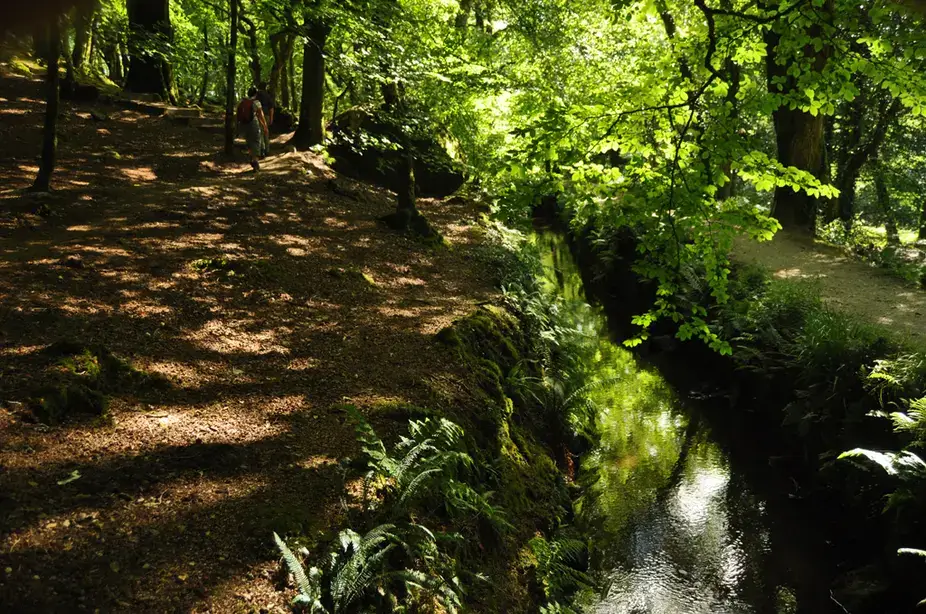
- Location: Luxulyan Valley, Mid Cornwall
- Dog-Friendly: Yes. There are no stiles on this walk and the route has no fields with livestock.
- iWalk Cornwall Route: Luxulyan Valley circular
- Distance: 3.4 miles / 5.5 km
- Difficulty: Easy-moderate
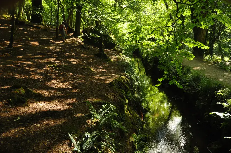
- Highlights: Lush broadleaf woodland, the Treffry Viaduct, a huge waterwheel, leats and horse-drawn tramways, riverside dragonflies and damselflies
Walk Description: A circular route that follows leats (water channels) and old horse-drawn tramways through the Luxulyan Valley, part of a World Heritage site. It leads to the massive Treffry Viaduct, which once carried the tramways towards Newquay, and to a huge waterwheel that provided the power to winch trams up the valley. Guidebooks have been recommending it since the 1920s as one of the finest walks in Cornwall. With no stiles and no livestock, it is the gentlest outing on this week’s list. Walking shoes are recommended.
2. Rough Tor and Brown Willy
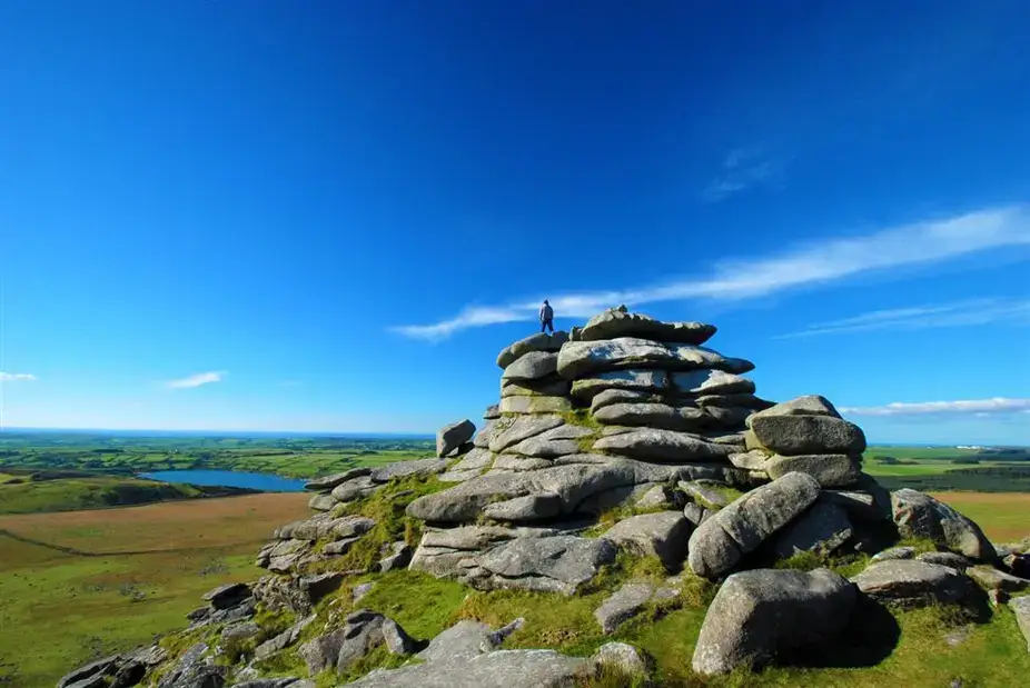
- Location: Bodmin Moor, North Cornwall
- Dog-Friendly: Yes, with care. There are two stiles on the climb to Brown Willy. The first sits beside a gate. The higher one is wired over, so dogs will need lifting to reach the summit. Sheep, cattle and ponies graze the open moor, and dogs must be on leads no longer than 2m between 1 March and 31 July, the breeding period for ground-nesting birds.
- iWalk Cornwall Route: Rough Tor and Brown Willy
- Distance: 5.2 miles / 8.4 km
- Difficulty: Moderate-strenuous
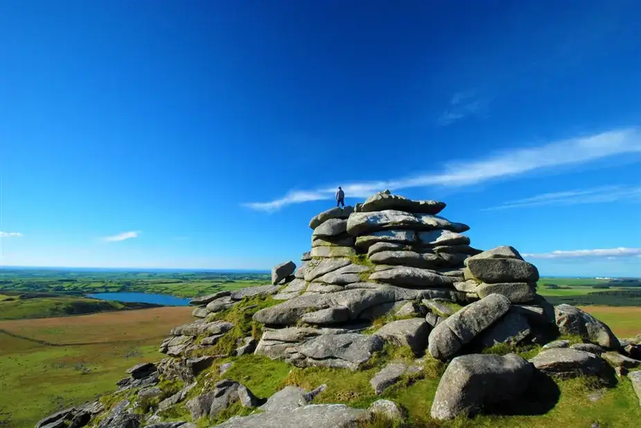
- Highlights: Roughtor, Showery Tor’s weather-sculpted granite, Brown Willy (the highest point in Cornwall), summit cairns, Roughtor Holy Well, Fernacre Stone Circle, Bronze Age hut circles, Stannon Lake
Walk Description: A mostly circular walk to Cornwall’s two highest tors. The route takes in Showery Tor and Roughtor, described by iWalk Cornwall as Bodmin Moor’s most rugged and iconic tor, before crossing the valley to Brown Willy, the highest point in Cornwall. Prehistoric remains are scattered along the way, including a holy well, summit cairns, a stone circle and Bronze Age hut circles, field systems and enclosures. There are granite boulders to pick through near the summit of Roughtor and on the descent into the valley between the tors. And the footwear advice is blunt: walking boots, because it is marshy even in summer.
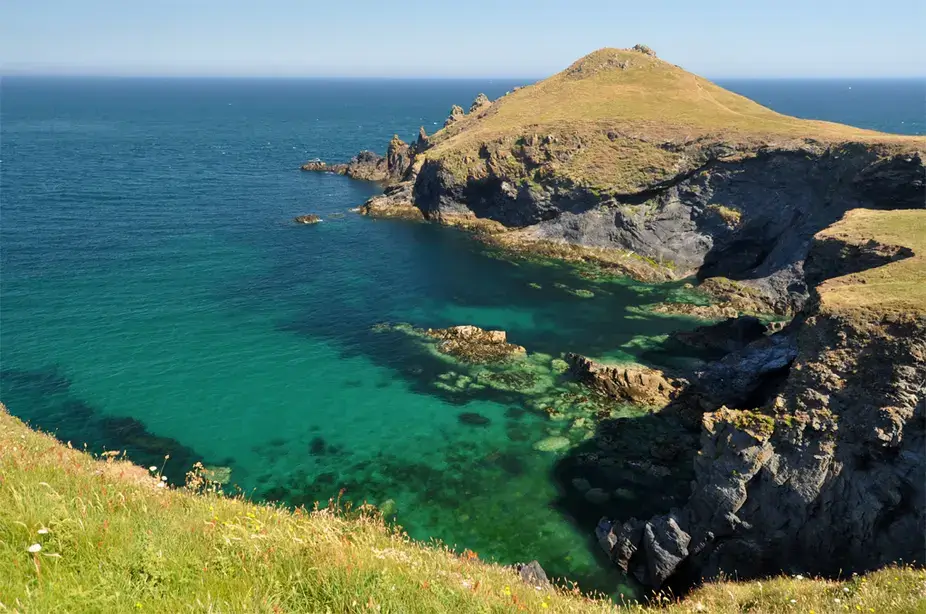
3. The Rumps to Polzeath around Pentire Point
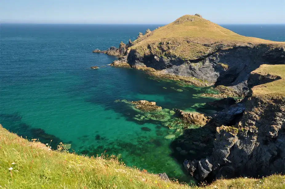
- Location: Polzeath, North Cornwall
- Parking: The National Trust car park at Pentireglaze, near the end of the route.
- Dog-Friendly: Yes. There are no stiles on the route. Pentireglaze Haven and Polzeath beaches have seasonal dog restrictions, so check before you go.
- Café: A National Trust café and a bookshop in the Pentireglaze car park, near the end of the route. A sensory orchard opposite the car park is a picnic spot.
- iWalk Cornwall Route: The Rumps to Polzeath around Pentire Point
- Distance: 4.2 miles / 6.7 km
- Difficulty: Moderate
- Highlights: Iron Age fort on The Rumps, Pentire Point, views over Port Isaac Bay and the Camel Estuary, rock stacks with seabird colonies, sandy beaches at Pentireglaze Haven and Polzeath
Walk Description: A circular walk across the Iron Age hillfort on the twin headlands of The Rumps, then around Pentire Point to finish at the sandy beach at Polzeath. The views run across Port Isaac Bay, the Camel Estuary and the offshore islands, and iWalk Cornwall’s own photos from the route include common dolphins off the headland. The path around Rumps Point is quite rocky and close to the cliff edge in places, and parts of the route run beside unfenced cliffs. A there-and-back to the headland on the left is offered as an alternative.
Your daily dose of Cornwall
News, events and goings on across the Duchy
4. Coverack to St Keverne
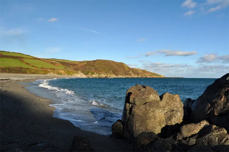
- Location: Coverack and St Keverne, the Lizard
- Dog-Friendly: Yes. Dogs are allowed on Godrevy Cove and Coverack beaches all year. The Dean Quarry stile can be bypassed around the right-hand end of the wall via the top of the beach. Very large dogs may need to squeeze through the gap at the stile after the Godrevy Cove footbridge, and less athletic dogs may need help over a wall on the final descent to Coverack. The other stiles should be passable by most dogs.
- Café: Roskilly’s Open Farm on the route, plus three pubs on or near it: The Paris Hotel, The Three Tuns and The White Hart.
- iWalk Cornwall Route: Coverack to St Keverne
- Distance: 5.7 miles / 9.2 km
- Difficulty: Moderate
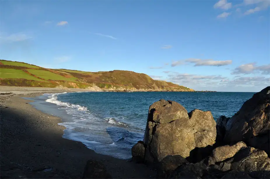
- Highlights: Coverack beach and its unusual geology, the Manacles reef, Dean Quarry, Trebarveth Saltworks, St Keverne Church and churchyard, Roskilly’s Open Farm
Walk Description: A circular walk from Coverack to St Keverne, past the Manacles reef, known as the grave of a thousand ships. According to iWalk Cornwall, at least a hundred wrecks have been recorded there and more than a thousand people have drowned. The route also passes Dean Quarry and the historic churchyard at St Keverne, with Roskilly’s Open Farm and its ice cream along the way. Walking boots are the advice here. Paths near Coverack are rocky, with small boulders that can become slippery after rain, and some sections run close to unfenced cliff edges.
5. Stepper Point and the Doom Bar
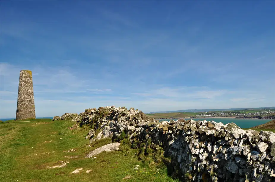
- Location: Stepper Point, near Padstow, North Cornwall
- Dog-Friendly: Yes. There are just two stiles. The first, out of the car park, has a gate alongside, and the second has a wall alongside that dogs can use to get past. The headland is grazed by cows and sheep, so dogs need to be on leads for part of the route. Harbour Cove is the beach where dogs are allowed all year.
- Café: A café is listed on the iWalk route page.
- iWalk Cornwall Route: Stepper Point and the Doom Bar
- Distance: 2.5 miles / 4 km
- Difficulty: Easy-moderate
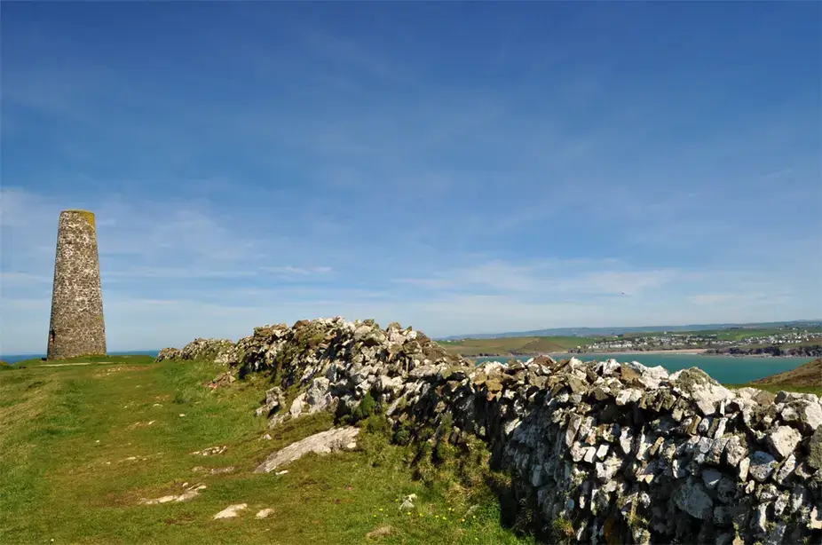
- Highlights: The Doom Bar, the daymark on Stepper Point (the Pepper Pot), Gulland Island, arches, islands and collapsed caves, sheltered sandy beaches at Hawker’s Cove and Harbour Cove
Walk Description: The shortest walk on the list is a circular route overlooking the Doom Bar, the sandbar that gives the beer its name. Hundreds of vessels were wrecked trying to enter Padstow harbour, and iWalk Cornwall notes that many still lie beneath the sands. The route climbs to the stone daymark on Stepper Point, known as the Pepper Pot, for panoramic views, and takes in the sheltered beaches at Hawker’s Cove and Harbour Cove. Some of the paths run close to unfenced cliff edges.
Plan your walk
The iWalk Cornwall app gives hand-written directions for each route, with GPS guidance that warns you if you stray off it. It works offline with no signal, which matters on the moor and along the more remote stretches of coast.
Again, this is not a paid partnership. The app is free to download from the App Store and Google Play, and you buy the individual walks you want. The full set runs to more than 300 routes across the county.
Share This Story, Choose Your Platform!
To keep up with the latest cornish news follow us below
Follow CornishStuff on Facebook - Like our Facebook page to get the latest news in your feed and join in the discussions in the comments. Click here to give us a like!
Follow us on Twitter - For the latest breaking news in Cornwall and the latest stories, click here to follow CornishStuff on X.
Follow us on Instagram - We also put the latest news in our Instagram Stories. Click here to follow CornishStuff on Instagram.
- 1
- 2
- 3
- 4
- 5
- 6






You Might Also Be Interested In






Discover More In Cornwall




Daily Cornish news by email
The latest daily news in Cornwall, sent direct to your inbox.